 ,
Gallup Park
(JPG),
Gallup (PNG),
Furstenberg (2017 PDF),
Ruthven (2020 PDF)
,
Gallup-Ruthven ,
Furstenberg
,
Gallup ,
Furstenberg
(brochure),
Ruthven
,
Gallup Park
(JPG),
Gallup (PNG),
Furstenberg (2017 PDF),
Ruthven (2020 PDF)
,
Gallup-Ruthven ,
Furstenberg
,
Gallup ,
Furstenberg
(brochure),
Ruthven
,
Gallup Park
(JPG),
Gallup (PNG),
Furstenberg (2017 PDF),
Ruthven (2020 PDF)
,
Gallup-Ruthven ,
Furstenberg
,
Gallup ,
Furstenberg
(brochure),
Ruthven
,
Gallup Park
(JPG),
Gallup (PNG),
Furstenberg (2017 PDF),
Ruthven (2020 PDF)
,
Gallup-Ruthven ,
Furstenberg
,
Gallup ,
Furstenberg
(brochure),
Ruthven
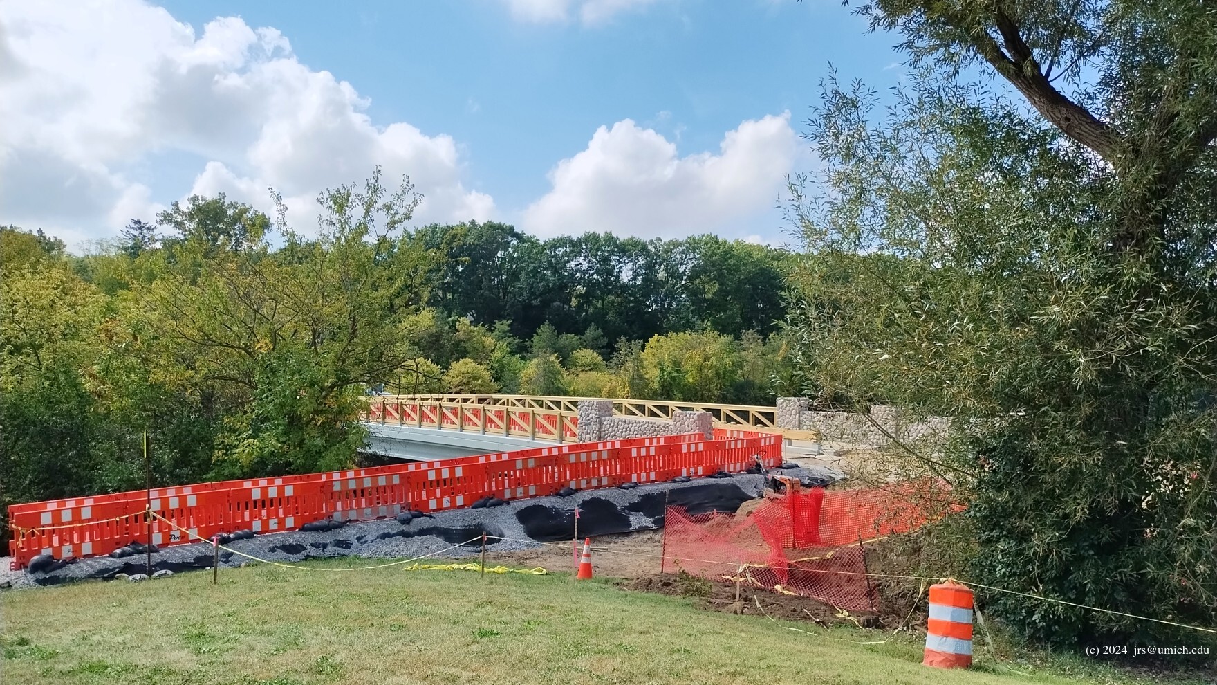
Update (October 2024): The new Gallup Park bridge
is open for pedestrian and vehicle traffic. See the city's ribbon-cutting announcement
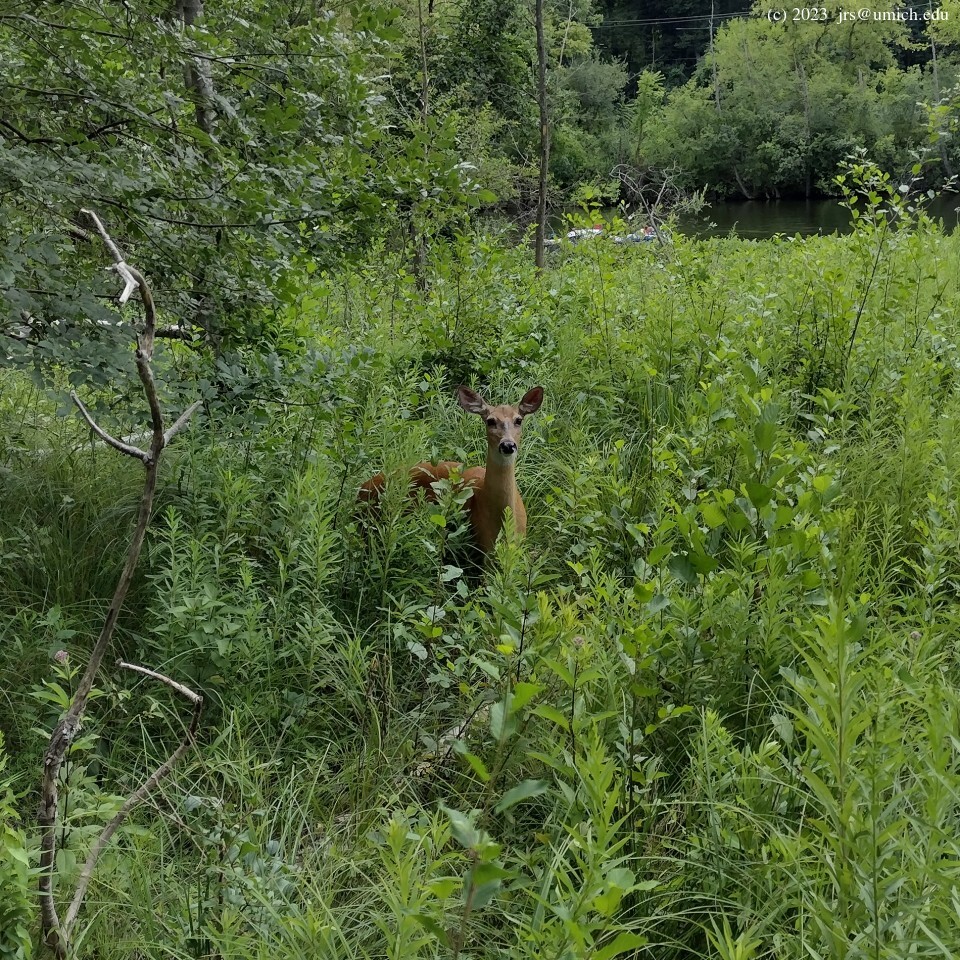
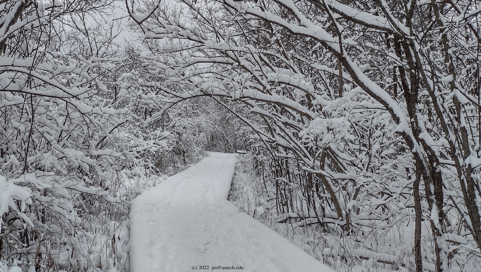
Photos from the Arboretum:


Overview: The Arb(oretum) belongs high up on the list of things that make Ann Arbor special. Tucked in next to the University of Michigan medical campus, it is a great spot to squeeze in a nature hike whenever you are nearby. And if you have more time, you can sneak out the back and reach Gallup Park and the Furstenberg Nature Area via Riverview Drive.
Leashed dogs are allowed at all of these sites.
Nappers are welcome to bring a blanket, but not a
hammock .
Parking: The main flaw of the Arb is that it is popular just about all of the time outside of winter or bad weather. Consequently, parking anywhere nearby can be a challenge. Of course if you have a UM blue permit, then you have quite a few options (I like Lot M-34 on Observatory), but even the nearby UM lots are generally going to be full from 8 to 4 Mon-Fri. For everyone else, here are some suggestions for parking:
Options: Some reasonable hikes (details to follow):
(add 0.5 miles).
And during the second half of May or first half of June,
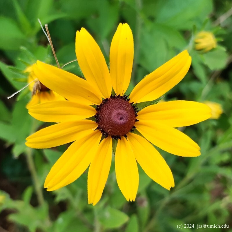
be sure to stop by the Arb's Peony Garden:
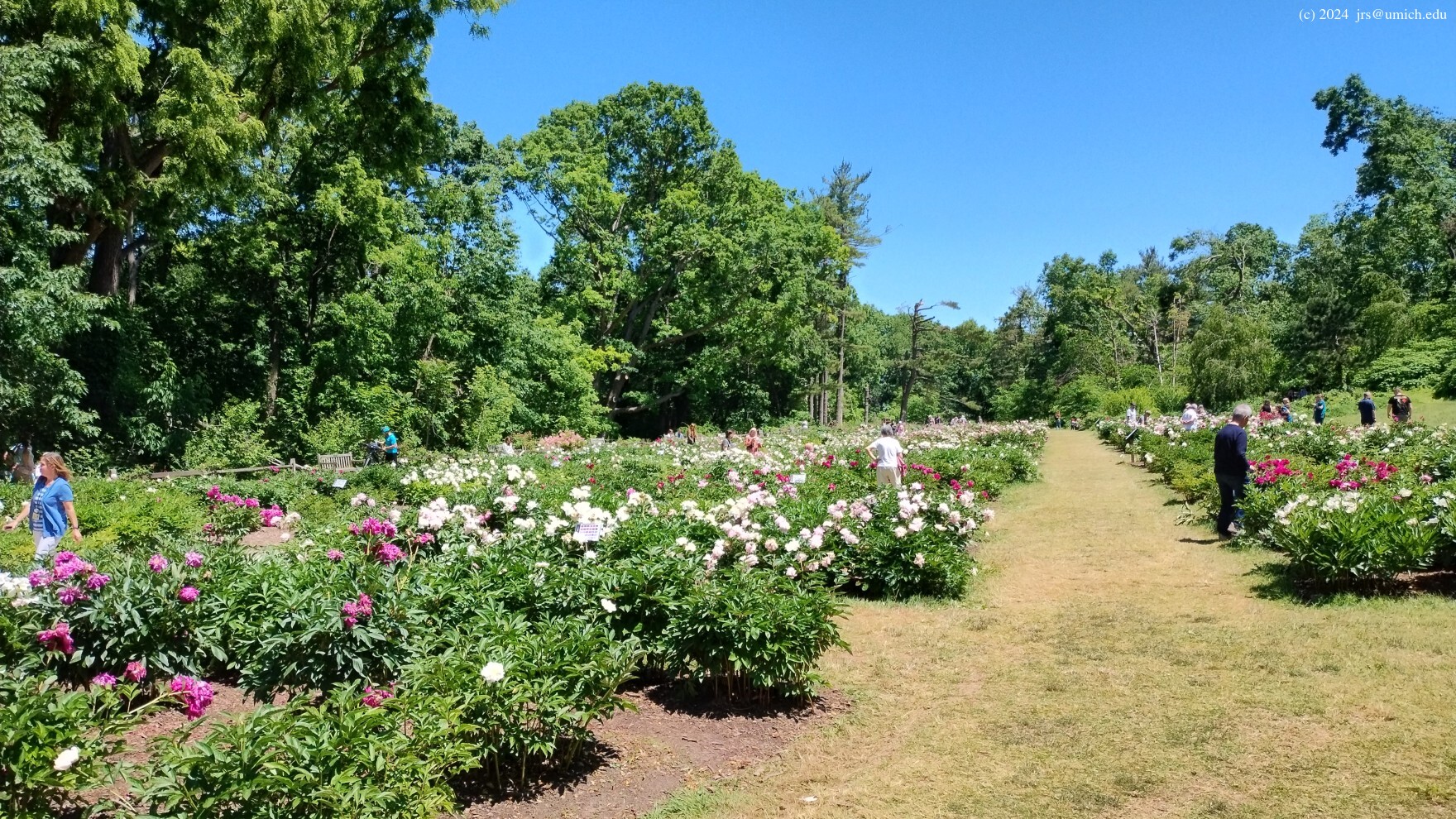


A hike that goes directly from the Arb's Washington Heights entrance to
the eastern boundary is about 0.9 miles one way, and from the Geddes Avenue
entrance it is about 1.1 miles. However, a lot of that is on dirt and
gravel roads that are of limited interest. Instead, once you pass through the
peony
garden ,
you should choose any of the paths on your right that take you down into
the Heathdale or the Main Valley and show off more of the Arb's natural
and human-curated wonders. From the Geddes Avenue entrance there are
similar "wilderness" options. The OpenStreetMap shows that there is much
more here than what you see on the official trail map.
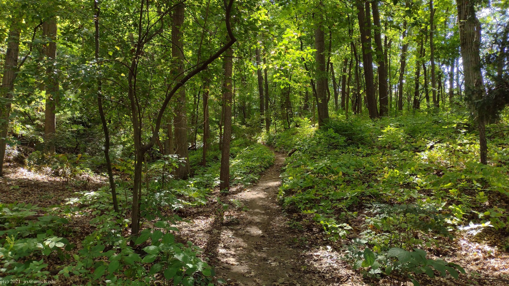
There are a few trails that traverse steep hills if you want your hike
to be strenuous. Note that the change in elevation from the Washington
Heights entrance down to the Huron River is about 120 feet. From Geddes
Avenue it is 185 feet. In any case, it is easy to devise a loop of 2
to 3 miles entirely inside the Arb. However, it is also easy for
adventurous first-timers to get disoriented, so you may want to bring
a compass or use a GPS app. Do make it a point to take in a
view of the Huron River
in the vicinity of trail marker #7.


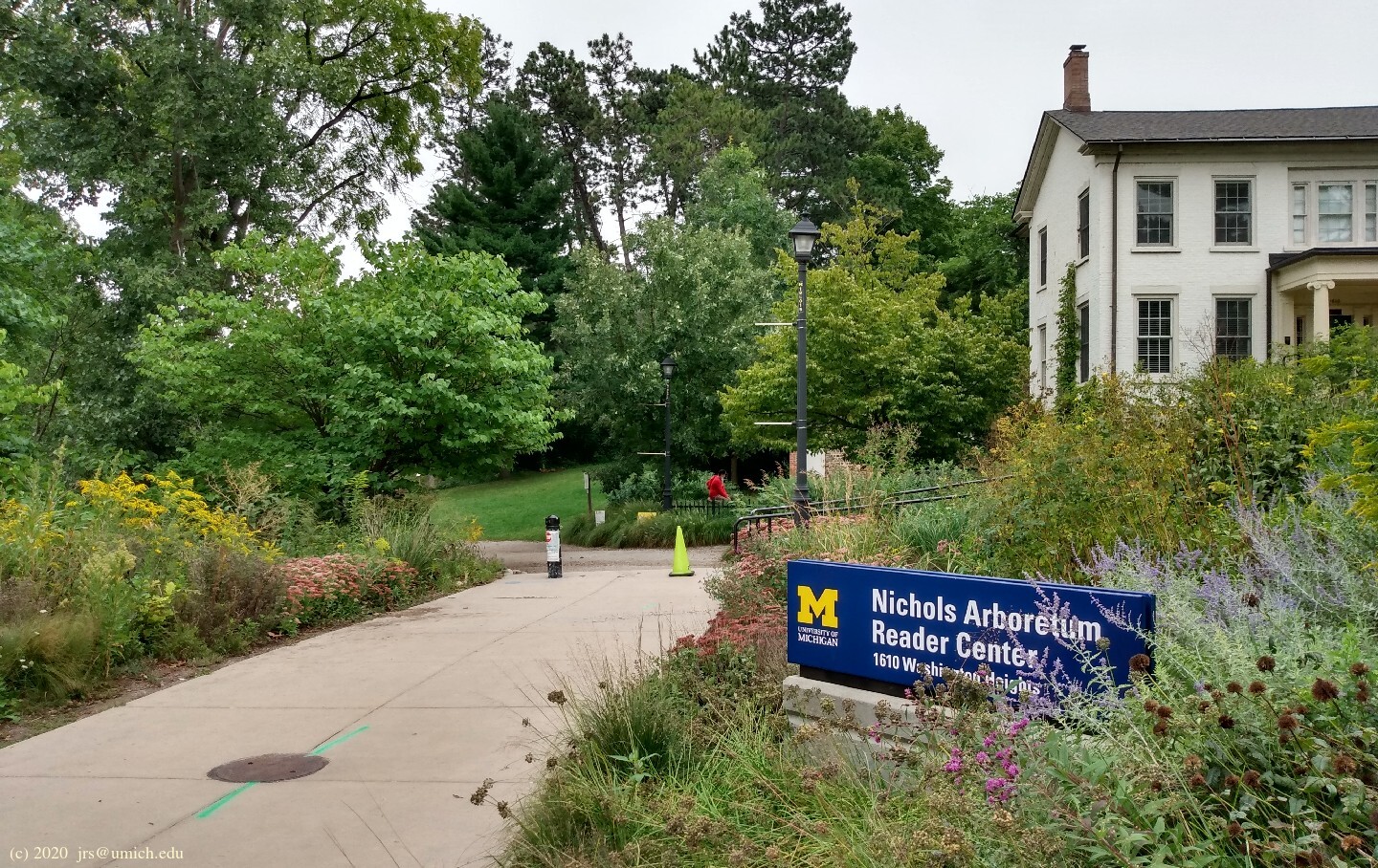
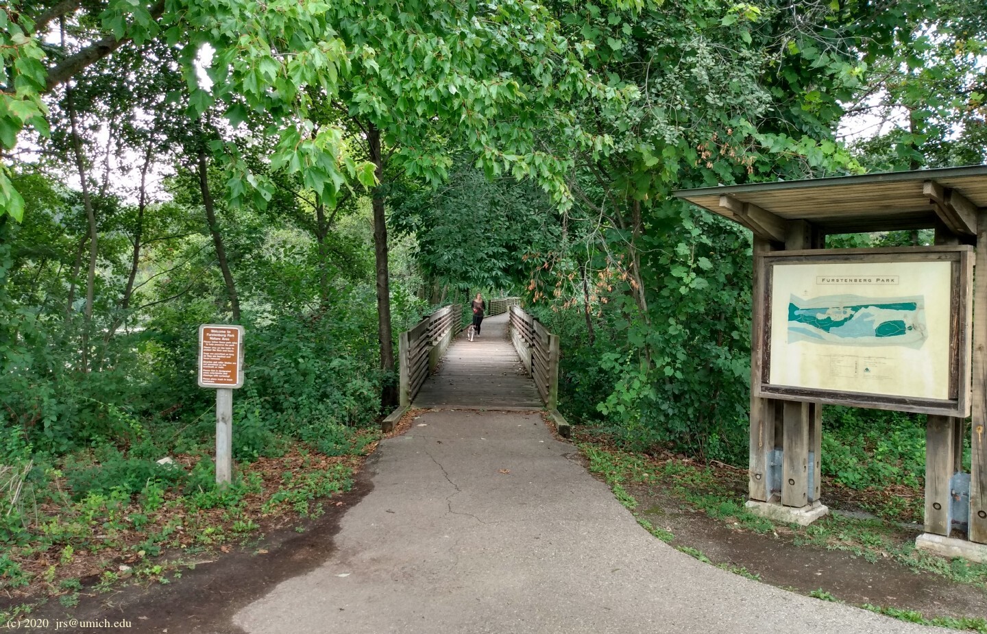
Getting there from the Arb:
At the eastern edge of the Arb there is a
short
walkway ,
complete with a large informative sign,
offering passage between the Arboretum and Riverview Drive.
Surprisingly, this entry point is not shown on Google's maps,
nor on the Arb's website. Perhaps the wealthy
homeowners living on Riverview Drive would prefer to have it unknown
to the public. [Update: Although the passage and some modest
signage remain in place, the fancy sign has been removed.]
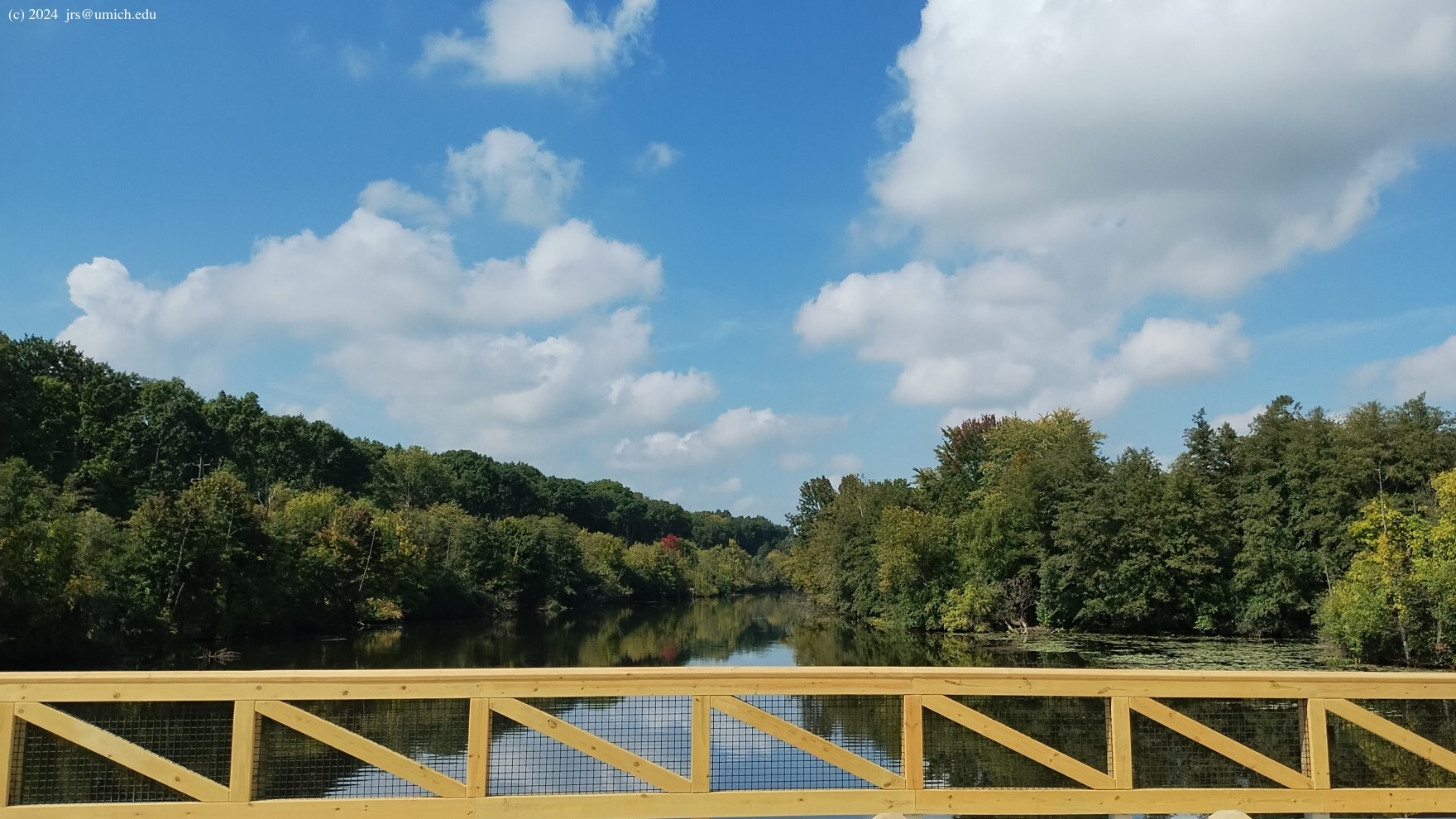
If you follow Riverview to Geddes Avenue, you will eventually reach a
railroad
crossing
for bikers and pedestrians. On the other side is a bridge across
the Huron River that marks the western edge of Gallup Park.
I've saved a map of this 1 mile route from the Arb to Gallup on
MapPedometer .
Caution:
Inside the Arb and not far from the Riverview exit, there is an
unsanctioned path that leads across the railroad tracks to a section
of the B2B Trail that runs parallel to the Huron River. Proceeding
downstream from there will take you to the bridge and into Gallup Park.
However, there are signs and barriers making it clear that crossing
the railroad tracks here entails trespassing on MDOT property.
There has been an ongoing battle of wills between the MDOT and local
miscreants, and it is apparent that they are becoming more
determined in their
efforts
to discourage would-be trespassers.
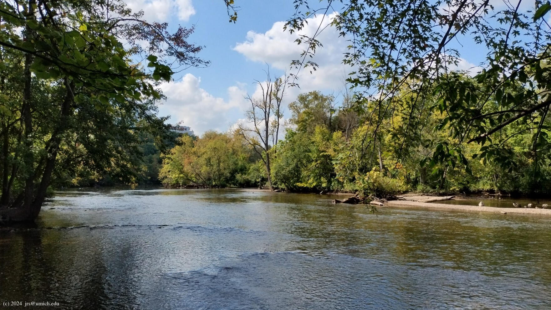
Assessing your options:
Once on the bridge, you should pause for a
moment to take in the
view . In the final years of the
old bridge, the view was marred by the addition of a chain link fence
on top of the guardrails. Let us hope we will have at least a few years
of fenceless views at this picturesque spot.
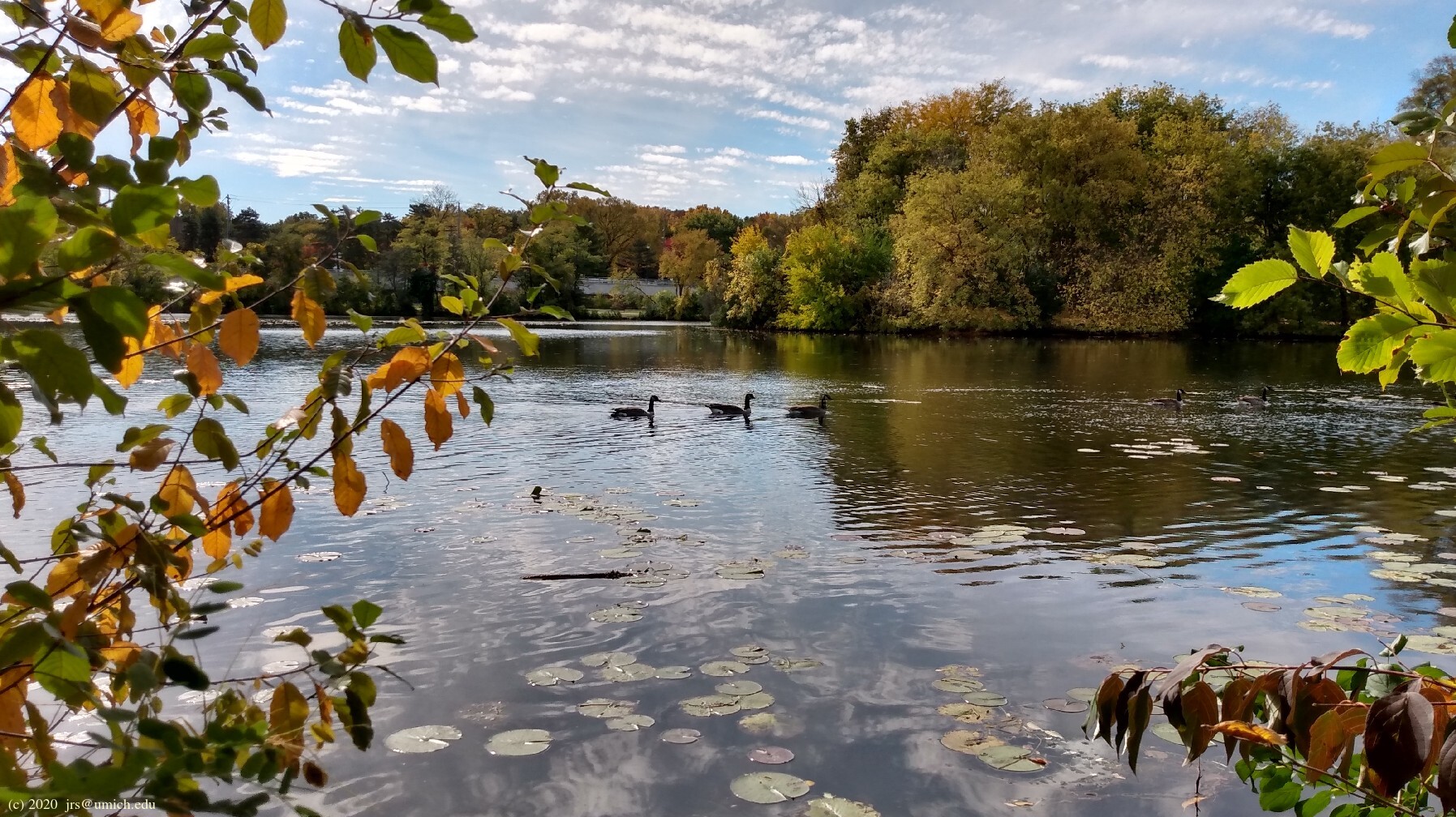
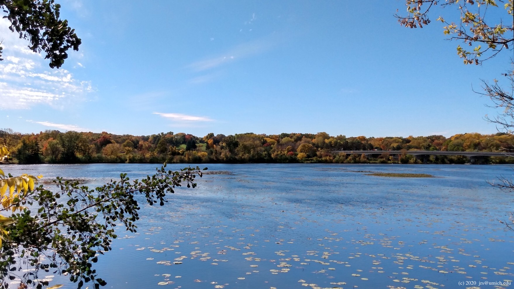
After crossing the bridge, one of your options is to stay on the
pathway and follow a clockwise loop around Gallup Park.
This will take you past the canoe livery on the north side of the
Huron and then through a chain of islands linked by pedestrian bridges
that return you to the south side. Although much of this loop is
on asphalt, along the way there will be numerous
panoramic views of
Geddes Pond .
The loop is either 1.35 or 1.65 miles long, depending
on whether you take the shortcut that runs alongside the playground
in the southeast corner of the park.
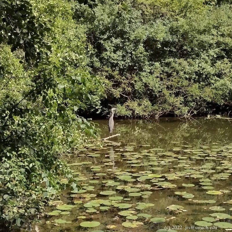
The Furstenberg Nature Area:
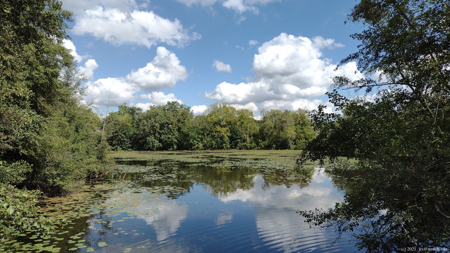
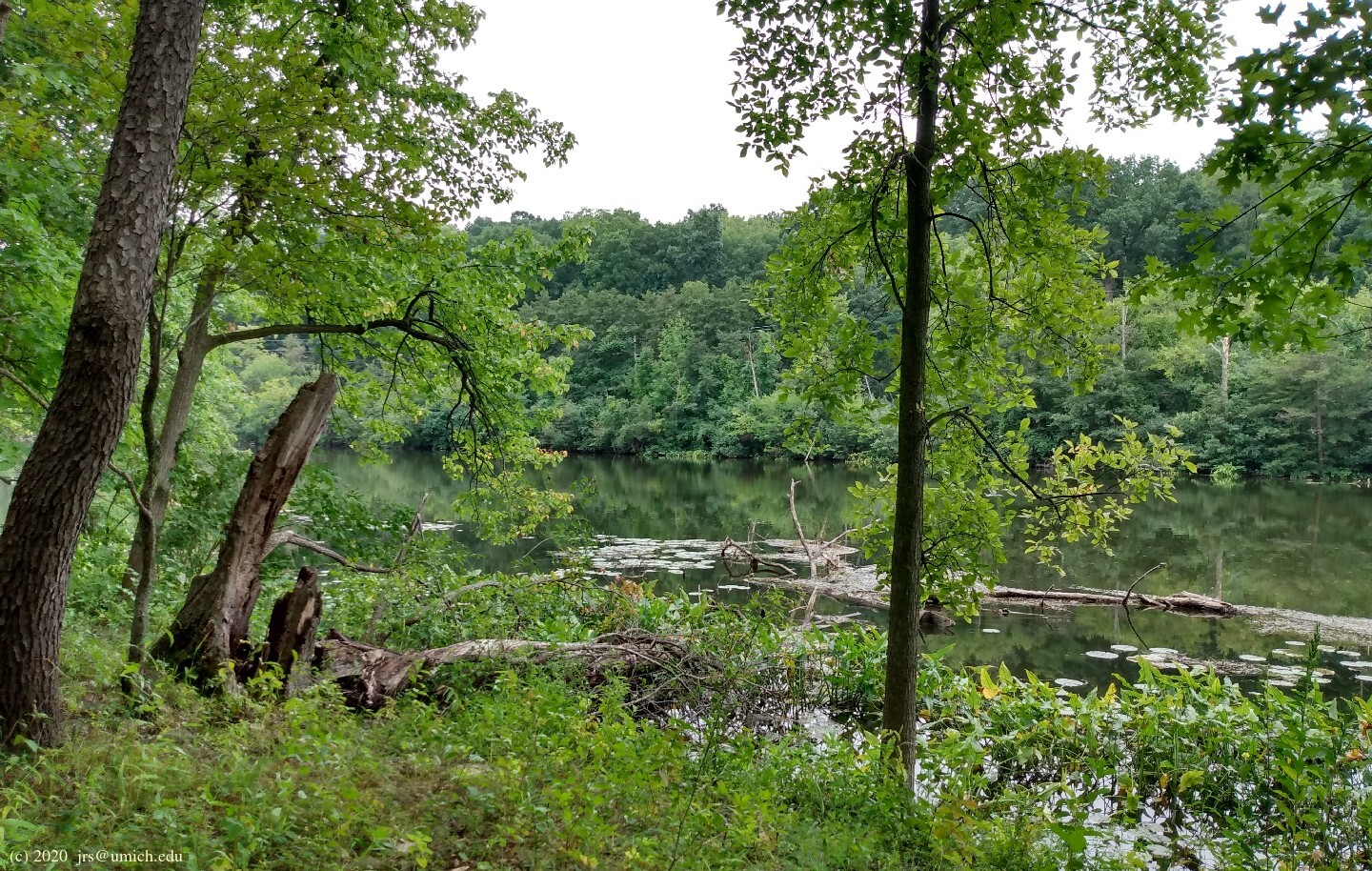
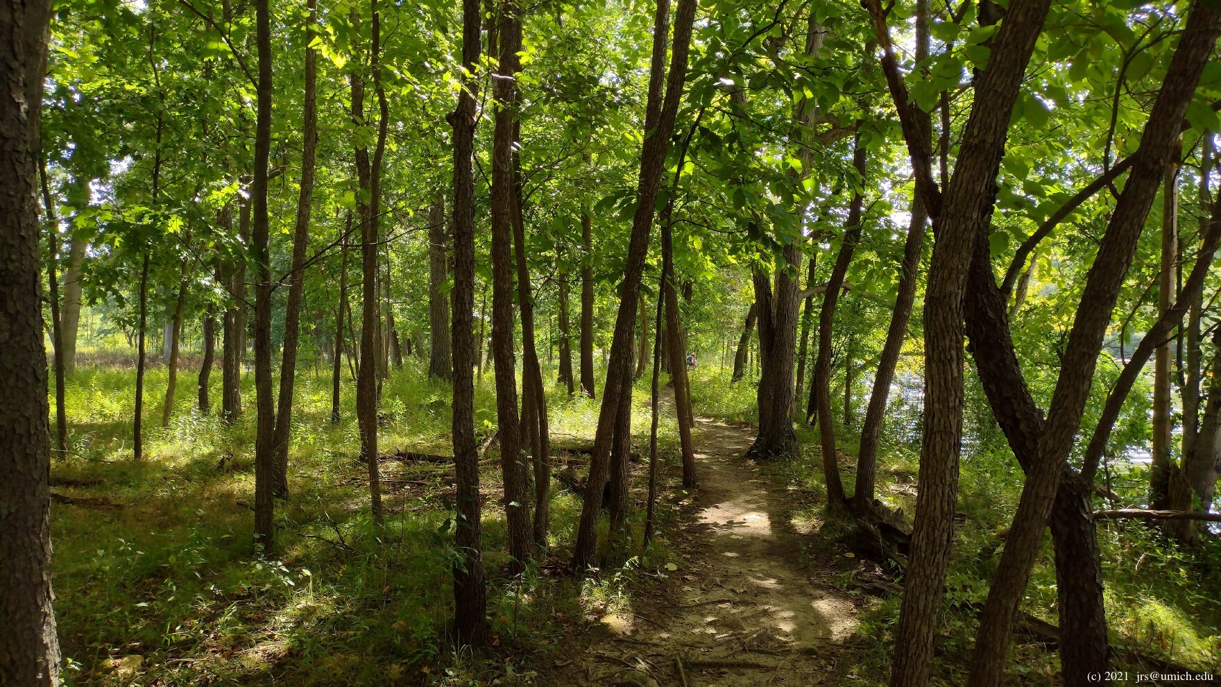

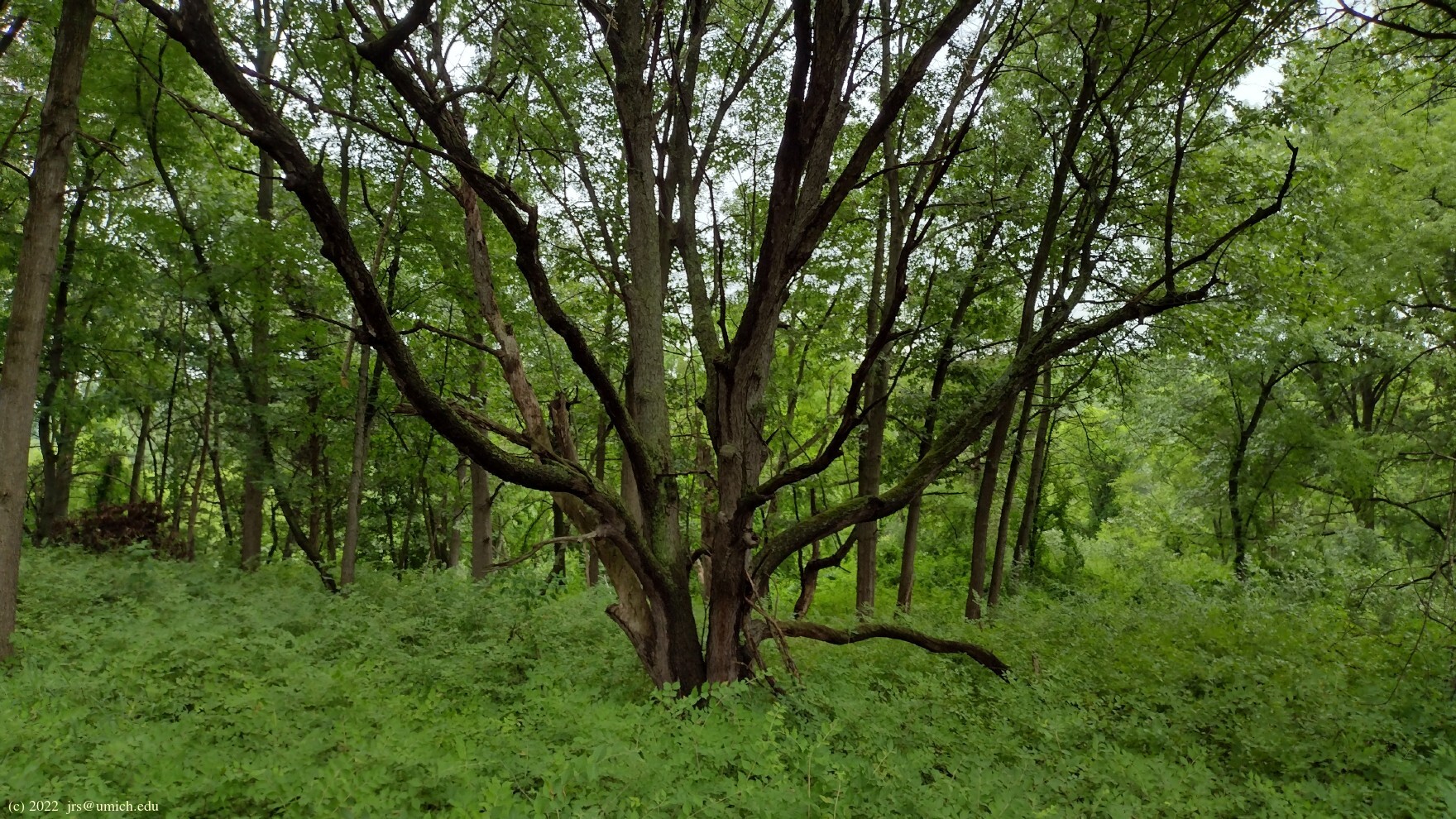
A second option after crossing the bridge is to bear left and explore the Furstenberg Nature Area. What you will find there is a mix of wetlands and woods on a finger of land that juts out and curls around a lagoon off of the Huron River. The trail is mostly unpaved aside from some boardwalks in marshy areas. A round trip from the entrance at Gallup Park to the far northwest end of the preserve is about 1.35 miles.
The Ruthven Nature Area:

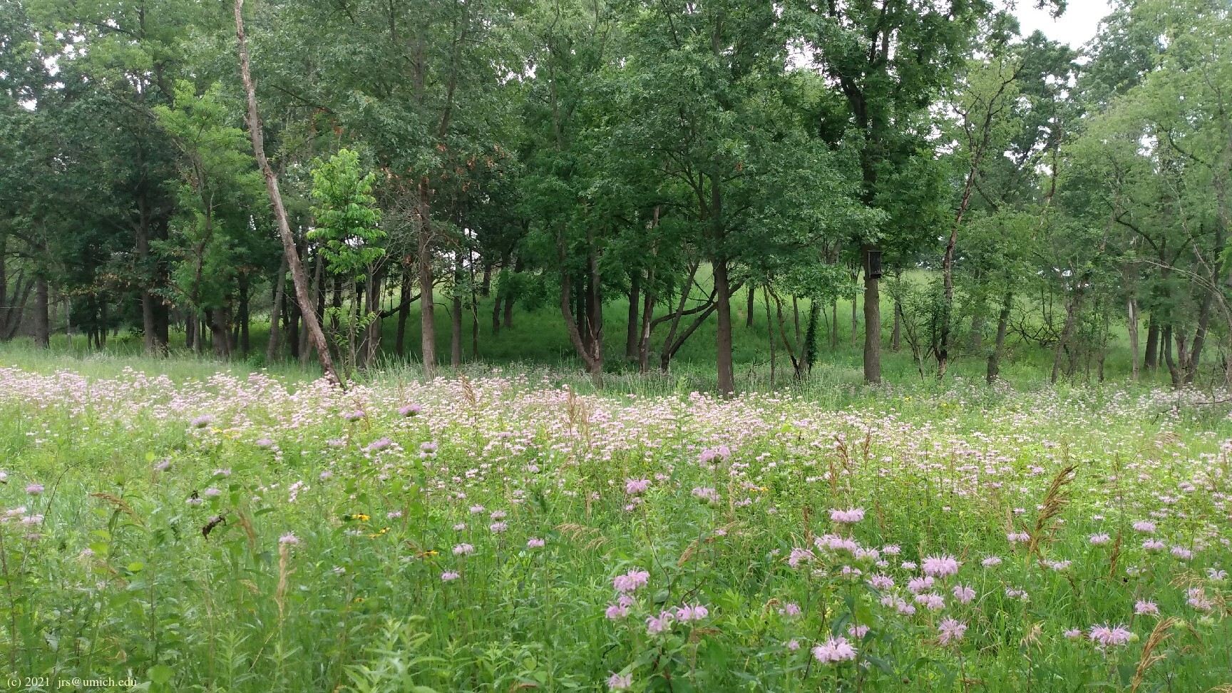
You can increase the Nature Quotient (tm) of a loop around
Geddes Pond by taking a 1/2 mile side trip to explore the
kame and
kettle terrain The 2024 Bridge Replacement:
The project to replace the arched wooden bridge in Gallup Park is
complete as of October 2024.
Although the old bridge remained open to traffic during the
initial stages of the project, it was dismantled early in 2024
for "public safety reasons." As a result, it became
challenging Excerpts from the websites:
Throughout the Arb you’ll find many special places to discover, including
extensive but dispersed collections of native and exotic trees and shrubs
masterfully crafted into a naturalistic landscape begun by O. C. Simonds
in 1907. The Arboretum is jointly owned by the City of Ann Arbor and the
University of Michigan as a resource for the entire community. As you
explore you’ll find one of the richest landscapes in the region, as well
as a complex glacial topography that presents vast panoramas, broad
valleys, and intimate dales and glens.
Gallup Park is a 69-acre park and is Ann Arbor’s most popular recreation
area. It is located along the Huron River and Geddes Pond with scenic
walkways that traverse small islands with bucolic pedestrian bridges.
The park contains two playgrounds, a canoe livery, picnic areas and grills
scattered throughout the park, and two picnic shelters.
Furstenberg Nature Area is a 38-acre park containing wetlands, woodlands,
prairie, and oak savannah. It is located on Fuller Road just west of
Gallup Park. A half-mile paved trail loops through the park, and a
granular trail goes through the prairie and woods, connecting to 1/4 mile
of wetland boardwalk. An interpretive brochure leads the visitor through
a series of numbered posts explaining the natural ecosystems.
in the 21 acre Ruthven Nature Area.
(Kames and kettles are the hills and basins left behind by a
receding glacier.) Although the entrance is unmarked, the
trail map (PDF)
shows that you will find an entry point on the north side of Geddes Road
east of Huron Parkway, directly across from a parking lot.
For added confirmation, look for the
bat
house straight ahead as you enter.
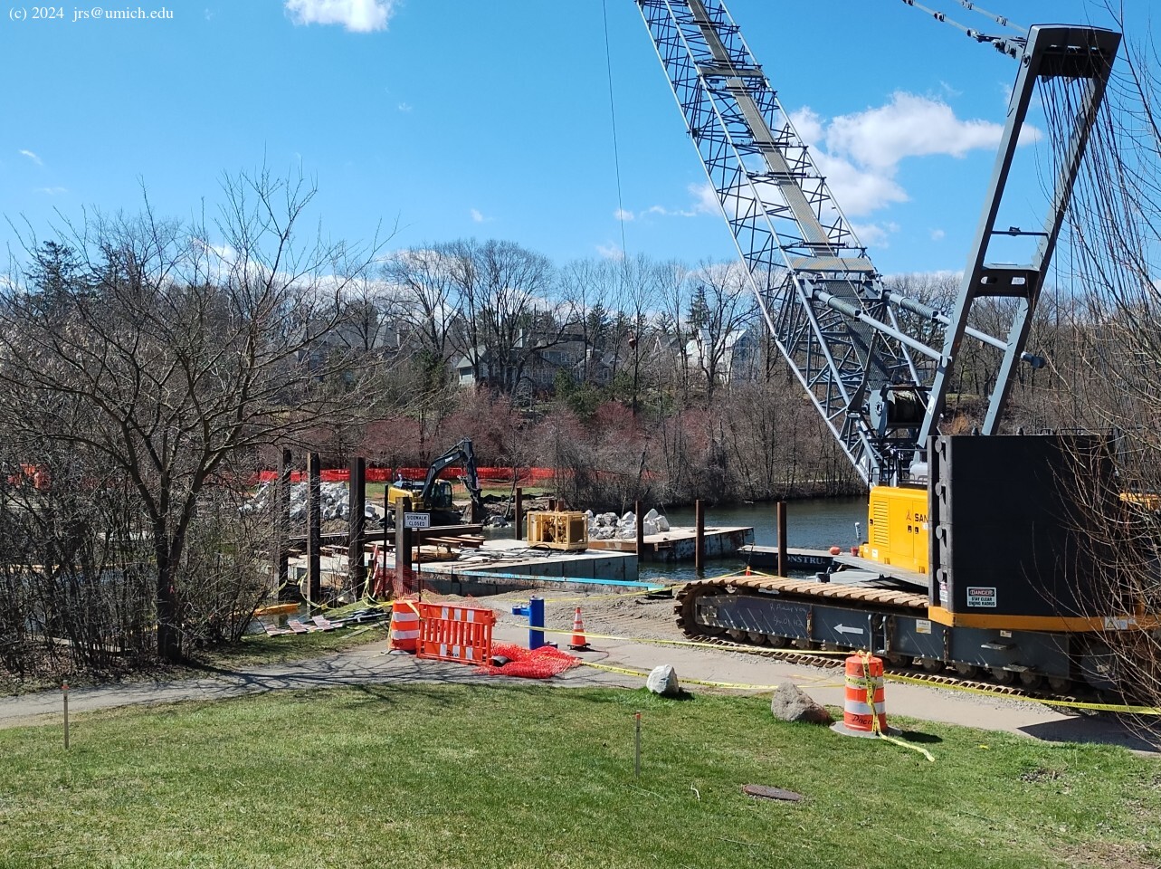
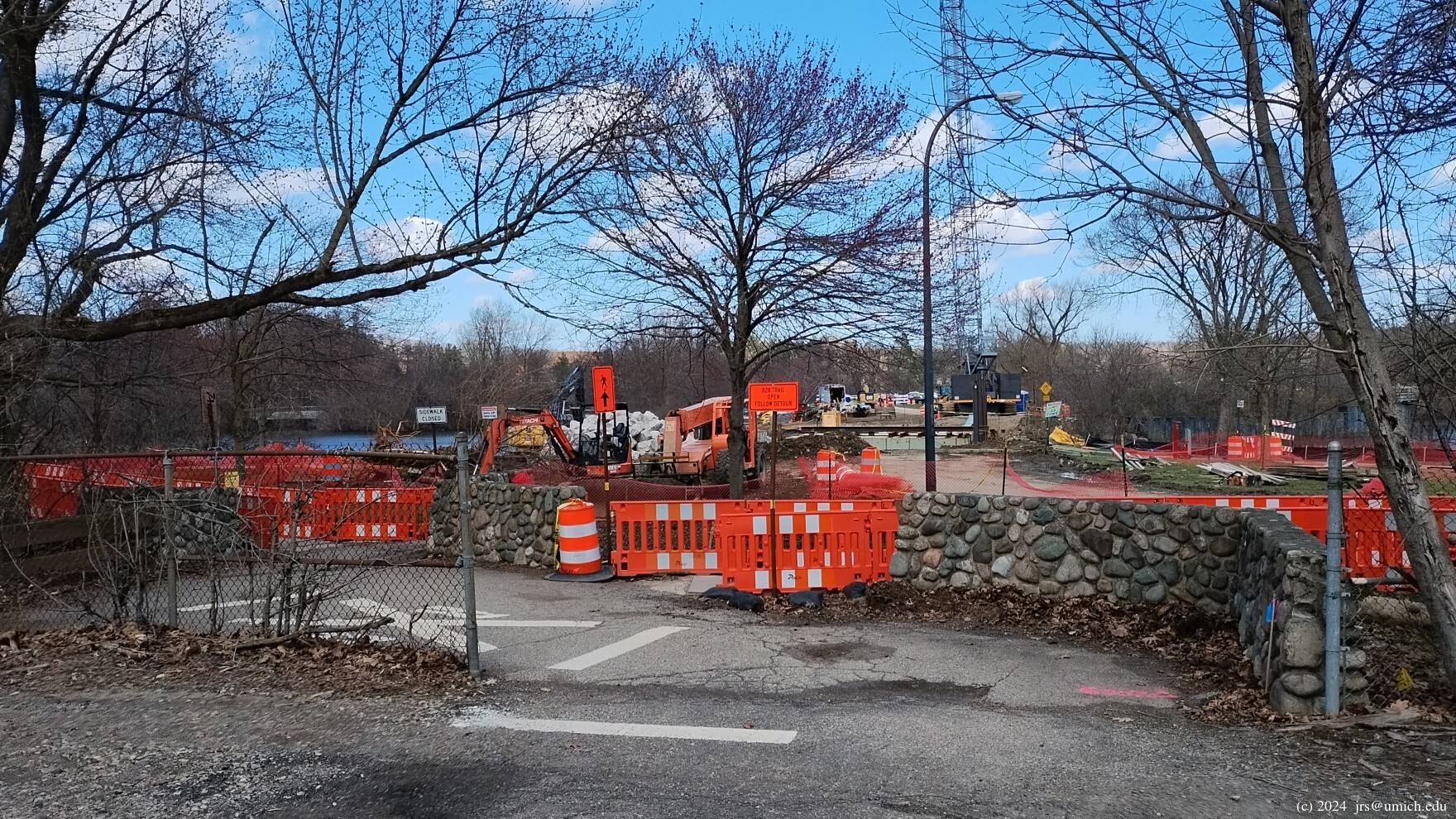
 for pedestrians to pass between the Arb and the heart of Gallup Park.
Although the closure is no longer an issue, it may be worthwhile to
remember that there is a second option for crossing
the Huron River on foot. It involves taking advantage of the
protected
sidewalks
available on both sides of Huron Parkway where it crosses Geddes Pond.
This offers a direct route to the north side of Gallup Park,
near where the canoe livery and Ruthven Nature Area are located.
On MapPedometer, I've saved a
2 mile route
that illustrates how to use this to fashion an unconventional
loop around the pond.
for pedestrians to pass between the Arb and the heart of Gallup Park.
Although the closure is no longer an issue, it may be worthwhile to
remember that there is a second option for crossing
the Huron River on foot. It involves taking advantage of the
protected
sidewalks
available on both sides of Huron Parkway where it crosses Geddes Pond.
This offers a direct route to the north side of Gallup Park,
near where the canoe livery and Ruthven Nature Area are located.
On MapPedometer, I've saved a
2 mile route
that illustrates how to use this to fashion an unconventional
loop around the pond.