 ,
OpenStreetMap
  (updated!)
 ,
county preserve
 ,
OpenStreetMap
  (updated!)
 ,
county preserve

Overview: The Watkins Lake site consists of a state park on the Norvell Township side (in Jackson County) and a Washtenaw County nature preserve on the Manchester Township side. The lake itself is in the state park and is known for attracting several waterfowl species. For hikers, the centerpiece is a point-to-point unpaved multi-use trail that runs from the lake area east for 3.5 miles to Austin Road near Manchester. Branching off from this main trail you will find three small networks of hiker-only trails that offer the chance to explore a variety of landscapes, including woods, hills, pasture, lakeshore, open meadows, and wetlands.
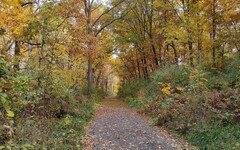
The main trail is
wide,
largely straight, and gently sloped  .
Following it east from Watkins Lake, it runs along a ridge line that
could be mistaken for an
esker
  .
However, when the trail later passes through a deep notch cut out
of a hill, any thoughts about eskers will evaporate -- it becomes clear
that there was substantial human effort involved in shaping the trail.
In fact the "esker" and the notch were constructed in the 19th century
as part of a railroad grading. Although there is no physical evidence
remaining of rails or ties, a flagpole and
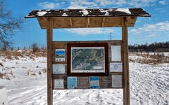
sign
  on the trail -- directly north of the lake -- commemorates the
site of "Watkins Station" on the
Lake Shore and Michigan Southern Railway
  .
.
An entirely different kind of railroad is also part of the history
of Watkins Lake. In the 19th century, the Watkins farm was involved
in the Underground Railroad  .
For more details, see this
county webpage
  .
.
Caution: The lake and some of the land surrounding it is a designated waterfowl refuge that is closed to visitors during the migratory seasons Feb. 15 to May 15 and Sept. 1 to Jan. 1. Fortunately for hikers, most of the trail network lies outside of the refuge area, and the boundary is clearly marked by fences, gates and signage. During the periods of closure, you still have the opportunity for up-close views of Watkins Lake from farther south on Arnold Road or from the Blue Trail.
Bikes and skis are allowed on the main trail; leashed dogs are allowed throughout. Be aware that hunting (in season) is allowed in an area north of the main trail on the Jackson County side.
According to the DNR website, there are plans to extend the main trail from Brooklyn to Manchester.
Heading west immediately north of the parking lot, the main
trail comes to an end after a short distance, and a hiker-only path
continues from there south into a
fenced
pasture  .
I have often seen turkey vultures (and once, a red-tailed hawk)
soaring overhead here.
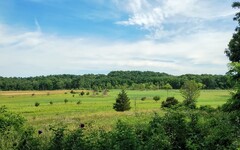
The highest point on this trail is a hilltop that provides a
wide-angle
view
  of the lake and the surrounding countryside.
A short spur near the hilltop leads deeper into the pasture while
the loop continues south and eventually east back towards the lake.
After crossing Arnold Road, the final leg (shown in yellow on the
2020 trail map)
enters the
waterfowl
refuge
  on the west side of the lake and eventually rejoins the main trail
about 0.1 miles east of the parking lot. If you are there during the
migratory seasons when the refuge area is closed, you should instead
head north on Arnold to return to the trailhead and parking lot.
The pasture loop, including passage through the refuge area to the point where it rejoins the main trail, is about 0.9 miles long. Including the spur will add another 0.4 miles.
Traveling eastward along the main trail from the parking lot
for 0.35 miles, you will cross over into Washtenaw County and arrive
at the entrance to the Blue Trail. (Note that the "blue" designation is
in place on the
2020 trail map
and the
OpenStreetMap  ,
but the 2024 map uses a different color scheme.)
This trail offers a wide variety of terrain, including
woods
  ,
grasslands
  ,
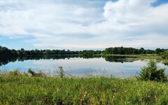
a 100 foot up-and-down hill climb, and good views from the
northeast
corner
  of Watkins Lake.
A full exploration of the Blue Trail will add about 1 mile to your hike.
Farther east along the main trail about 1/2 mile after crossing Noggles
Road is the first of three
entrances  into a network of trails inside the nature preserve.
Extensive renovation and reconfiguration of these trails
took place in 2021-22, and as a result, the 2020 trail map is no longer
accurate. Instead one should rely on the new
2024
map
  posted at the Arnold Road trailhead and at Noggles Road. (See also this
preserve-specific
map
  posted temporarily at the trailhead for a special event in 2022.)
The OpenStreetMap has now been updated (new as of Spring 2024) and shows the new layout, although one of the two north/south segments that it shows in the northeast corner of the preserve was part of the old network and no longer exists.
In the new configuration, the preserve trails take you through open
fields of tall prairie grass and into some dense woods on
the south and west sides of this rectangular parcel of land.
Small ponds and wetland areas are scattered throughout.
It also features a hilltop offering
panoramic
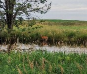
views  of the surrounding farmland. Deer are fond of the woods here and
wild turkeys are sometimes found in the adjacent grassy areas.
During the growing season you can expect to see a wide variety
of wildflowers.
An exploration of the nature preserve is likely to add 1 to 2 miles to your hike -- a grand tour following the outer loop is about 1.7 miles long. A round trip starting from Noggles Road is about 2.7 miles long.
Planning your hike: A no-frills hike along the main trail heading east from the Arnold Road trailhead will cross Noggles Road after 1 mile, Sharon Hollow Road after 2.6 miles, and end at Austin Road after 3.5 miles. The three entry points into the nature preserve trail network are on the south side of the main trail at a distance of 1.5, 1.8, and 1.9 miles from the trailhead.
It is possible to enter the main trail from Sharon Hollow or Austin Road, but parking there is limited to the roadway shoulder. If you'd rather explore the nature preserve without having to hike the full 1.5 miles each way from the Arnold Road parking lot, the best option would be to park on the shoulder of (unpaved, quiet) Noggles Road near the trail crossing.
On MapPedometer, I've saved a route map for a
7 mile hike  that includes the pasture loop, the Blue Trail, and a tour of
the nature preserve area. If you have a limited amount of time to spend
in the lake area, I would prioritize including the Blue Trail and
omit the pasture loop.
Directions: Head west on I-94, then south on M-52 near Chelsea (Exit 159). The first traffic light you encounter will be 7.5 miles later at Pleasant Lake Road. Turn right (west) onto Pleasant Lake. Eventually it veers south and becomes Sharon Hollow Road. After you pass through Sharon Mills (the site of Hike #1), Sharon Hollow seemingly ends at Sharon Valley Road, but there is a short jog to the left (east) where Sharon Hollow continues south. After crossing Austin Road, turn right (west) onto Herman Road. Follow Herman Road for about 2.5 miles, turning right onto Horning Road. Look for the Arnold Road entrance to Watkins Lake on the right after about 1/4 mile. The parking lot is located about 3/4 of a mile farther north.
Driving time from the Jackson Road entrance to I-94 on the west side of Ann Arbor is about 35 minutes.
A Michigan
recreation passport  is required for vehicle entry.
Excerpts from the websites: Watkins Lake State Park & County Preserve is a popular watchable-wildlife destination and features beautiful rolling land covered in a mixture of open meadow, mixed hardwoods, low wetland areas, open water, and the property’s most popular feature, Watkins Lake. [The lake] has been designated a Waterfowl Refuge by MDNR due to the significant habitat provided for migrating and breeding birds; many species of ducks, geese, grebes, and more may be seen, especially in spring and fall.
The park now also will be recognized for its connection to the Underground Railroad. The National Park Service recently accepted Watkins Lake State Park and County Preserve, into the National Underground Railroad Network to Freedom. The designation places the site in a permanent database that includes sites, facilities and programs that have a verifiable association to the Underground Railroad.
In the summer of 2018, WCPARC and MDNR officials adopted the General Management Plan for the park. While recreational opportunities are being developed, the partners have opened five miles of trail that follows the former railroad grade from a parking lot off Arnold Road to grasslands in the eastern portion of the preserve.