 ,
OpenStreetMap
 and
brochure (2010 PDF with outdated map)
 ,
OpenStreetMap
 and
brochure (2010 PDF with outdated map)
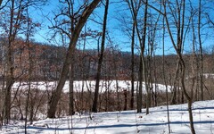
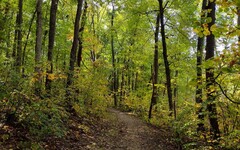
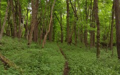
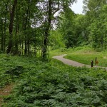
Photos from Park Lyndon South and farther south on the W-P Trail:
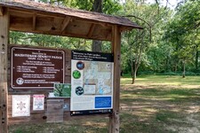
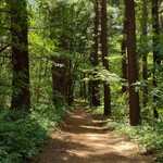
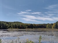

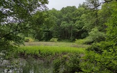
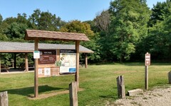
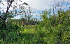
Photos from Park Lyndon North and farther north on the W-P Trail:
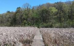
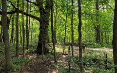

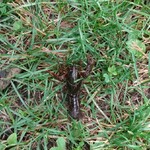

Overview:
This large nature preserve has ample parking and direct access
to the 35 mile Waterloo-Pinckney Trail. Inside the park there is an
extensive trail network to guide you through landscapes featuring
fens, marshes, ponds, forest, and prairie.
Much of the terrain here has been molded by glaciers; as a result,
there is a fair amount of traversing up and down hills and basins
(kames and kettles). The spur trail in the southwest corner of the
park will take you to the top of
a kame overlooking
Lake Genevieve  .
.
Wildlife highlights on my first visit included nearly stepping on a
water snake sunning itself on a dock, and spooking a couple of foraging
deer and a ground hog. I had no idea that ground hogs could
climb trees! [Update: A few years later, I again spotted a
water
snake  lounging on the dock.]
Leashed dogs are allowed in the park, but no hunting.
Mountain biking was at one time forbidden throughout the park, but as
mentioned in the Important Update below and as
posted
on-site  ,
bikers are now allowed to pass through the park on the
Orange Trail, between Markers 7 and 8.
A grand tour around the perimeter of the trail network, between Trail Markers 1 and 7, is about 2.6 miles long. A round trip to the kame adjacent to Lake Genevieve will add another 0.7 miles to your hike.
And of course you are free to venture further out along the W-P Trail, either south towards the Waterloo Recreation Area [see Hike P2] or northbound into the Pinckney Recreation Area [see Hike P3]. If you do, keep in mind that you will be passing through areas where hunting (in season) is allowed.
Important Update: The mountain biking crowd seemed to think it unbearable that one could not easily ride one's bike from the Potawatomi Trail on the east side of the Pinckney Recreation Area over to the DTE Energy Foundation Trails west of M-52. And apparently, the mountain biking crowd gets whatever it wants. Consequently, on June 25, 2022, the Waterloo-Pinckney Trail was opened up to two-way mountain bike traffic throughout nearly all of the Pinckney Recreation Area. The only exception is the area west of Embury Road and north of or within Park Lyndon.
However, Park Lyndon has not been completely spared. In order for mountain bikers to suffer only minimal inconvenience while passing through the area, a short trail segment in the southwest corner of the park, from Marker 7 to Marker 8 on the Orange Trail, has been opened up to bike traffic. Combined with a north-south segment on Embury Road this allows bikers to route around this brief bike-free zone on the W-P Trail.
In connection with these new arrangements, some minor changes in the
trail network at Park Lyndon have been made. In particular,
eight trail crossing markers have been added, with
updated
maps Re-routing the Waterloo-Pinckney Trail:
Accommodating the mountain bikers has also led to changes
south of Park Lyndon.
If you hike south on the W-P Trail for 1 mile starting from the
south pavilion at Park Lyndon, you will arrive at a
T-intersection
However, some fallen tree limbs have been arranged to discourage
use of the left branch, and trail markers have been added to indicate
that the W-P Trail now continues westbound along the right branch.
This new route eventually
joins
The OpenStreetMap now shows only the new route; the old
routing of the W-P Trail is no longer visible.
The new route does have advantages. It passes through a more
attractive wooded area, avoids the need to scramble across busy M-52,
and offers a close-up view of
Green
Lake Pipeline Update:
In 2023, Consumers Energy installed a new natural gas pipeline that
runs alongside M-52. For a few months, the
work
zone Island Lake and Gorman Lake:
If you head south from Park Lyndon on the W-P Trail for 1 mile
and turn left at the previously mentioned
T-intersection
Heading north from the crossing is a spur trail (1.1 miles out-and-back)
that runs along the east side of Island Lake, ending unceremoniously
at Island Lake Road. This trail seems to receive a
fair amount of traffic and should be easy to follow year-round.
Heading south from the crossing is one end of a 2.25 mile trail that
loops around Gorman Lake, returning to the no-name trail at a point
about 0.2 miles farther east.
If you are looking for a hike that challenges your navigational skills,
this loop should fit the bill. It is rough in places -- if it receives any
maintenance at all, it is probably from hunters during the deer season.
During the warmer months, the trail may
be virtually impassable. You can expect walls of underbrush and downed
branches blocking the trail in multiple locations. However, during the
colder months with minimal foliage, you may be able to tunnel your way
through and find where the trail continues.
On MapPedometer, I've saved a route map for a
6.6 mile round trip
Another worthwhile side trip if you head south on the W-P Trail from
Park Lyndon can be found on the other side of M-52 inside
the Waterloo Recreation Area.
About 1/4 mile after you cross the
Green Lake access road, the W-P Trail emerges from the woods into
an open meadow. Look for
a trail
immediately on your left
I've saved a route map for a 6.2 mile round trip from
Park Lyndon to Long Lake on
MapPedometer Directions:
Head west on I-94 toward Chelsea. Take Exit 162 (Old US-12)
and continue west another 2 miles. Turn right (north) onto M-52
(aka Main Street) in Chelsea. Follow M-52 for about 6 miles, then turn right
onto North Territorial Road. You will first see the parking lot for the
north side of Park Lyndon on the left after about 1 mile. If you pass it
by too quickly, you have a second chance with the south side parking lot,
about 100 yards later on the right. For added confusion, about 0.2 miles
farther east there is a sign for a second entrance to the south side of
Park Lyndon, but it is a gated entrance for service vehicles only.
From the Jackson Road entrance to I-94 on the west side of Ann Arbor,
it takes about 25 minutes to reach Park Lyndon North or South. It will
depend on how much traffic there is in downtown Chelsea.
Excerpt from the website:
Located in the hilly northwestern corner of the county, Park Lyndon contains
one of southern Michigan's finest natural areas. Over 500 species of plants
are found in a wide variety of habitats including fens, marshes, bogs,
ponds, forest, and prairie. Two miles of marked nature trails wind through
the steep, glacially sculpted hillsides, connecting to the state's
Waterloo-Pinckney Trail.
 posted at each location.
Also, the network has been re-partitioned into Red, Blue,
Yellow, Green, and Orange Trails. The Waterloo-Pinckney Trail coincides
with the Blue Trail in this area. On the old trail maps,
the network was partitioned into Blue, Yellow, and Green loops.
The trail map and brochure posted on the park website has not been
updated and is therefore less reliable.
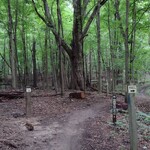
 .
The W-P Trail turns right here and heads due west, arriving at another
trail
fork
  after about 1/3 of a mile. Prior to June of 2022,
the W-P Trail followed the left branch of this second fork, eventually
entering the Waterloo Recreation Area after crossing M-52.
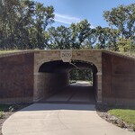
 the B2B Trail for about 1/2 mile,
passing underneath M-52 through a pedestrian/bike
tunnel
  and turning left (south) to rejoin the old route at the point where
it enters Waterloo. Mountain bikers would turn right (north) before
passing through the tunnel on their way to the DTE Energy Foundation
Trails. For the time being, the Waterloo portion of the W-P Trail
is still a no-bike zone.
 .
On the other hand, it also adds 0.4 miles to the hiking distance from
Park Lyndon to Waterloo.
 blocked passage between the east (Pinckney) and west (Waterloo)
sides of M-52 on the W-P Trail.
I am happy to report that as of 2024, the work in this area is
finished
  .
Hikers on the W-P Trail may once again pass unimpeded on their way
back and forth between Pinckney and Waterloo.
 ,
you will find yourself on a hilly
nameless
trail
  that runs due east for another 0.9 miles,
ending at a modest parking lot with a
minimalist
trailhead
  .
At about the halfway point, you will come to a
trail
crossing
  that offers two interesting detours.
 that includes the Gorman Lake loop and the Island Lake spur.
 heading south along the forest/meadow boundary. This unnamed trail
is a bit faint in places but not as challenging as the Gorman Lake
loop mentioned earlier. It passes through
forested
rolling hills
  and offers a
peek at
Long Lake
  and the extensive wetlands north of it. The trail loops back on itself
and returns you to the same spot on the W-P Trail after about 1.25 miles.
 . It uses the old routing
of the W-P Trail on the outbound portion of the hike and returns via
the new route.