 ,
Big Portage Lake
  ,
DTE Energy Foundation Trails
 ,
Big Portage Lake
  ,
DTE Energy Trails
 [park map],
Discovery Center
  ,
DTE Energy Trails

 ,
Big Portage Lake
  ,
DTE Energy Foundation Trails
 ,
Big Portage Lake
  ,
DTE Energy Trails
 [park map],
Discovery Center
  ,
DTE Energy Trails

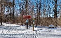
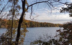
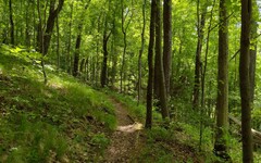
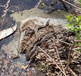
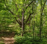
Photos from trails west of the Discovery Center:
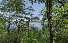

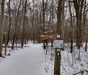
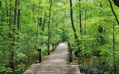
Photos from trails east of the Discovery Center and near Cedar Lake:


Overview: The Waterloo Recreation Area is the largest state park in Michigan's lower peninsula. It has numerous options for hiking and backpacking, highlighted by the 35 mile Waterloo-Pinckney Trail.
A good place for a hiker to begin exploring the park is at the Discovery Center, about 3 miles west of Chelsea. The trail network there offers several loops and a spur trail that all branch off of the W-P Trail. Another option is to choose any of the convenient points of departure for day hikes on the W-P Trail discussed below. You can also gain access to the trail from slightly beyond the eastern side of the park at Park Lyndon [see Hike #2].
If you need even more hiking options, you might consider the new-ish DTE Energy Foundation Trails, a collection of four loops (Green Lake, Big Kame, Winn, and Sugar) with a combined length of 22 miles. These are clustered on the east side of the park, with trailheads on M-52 and Cassidy Road. Although these loops are open to hikers, they are designed primarily for and by mountain bikers.
Bikes are not allowed on the Discovery Center trails and the parts of the W-P Trail inside the Waterloo Recreation Area.
Also be aware that hunting (in season) is allowed in most of the park. However, the Discovery Center and its trail network (with one exception noted below) is in a no-hunting zone.
Leashed dogs and cross-country skiing are allowed on the trails.
Discovery Center West.
Starting from
Trail
Marker 5  near the south parking lot, it is 1.6 miles along
the W-P Trail to the head of the Hickory Hills Trail near the park
headquarters (Marker 12). Note that when you cross Ridge Road
at about the 1.4 mile mark, you will be leaving the no-hunting zone.
The Hickory Hills Trail is a 1 mile loop that takes you down into a
tree-filled
ravine
  and along the north shore of
Crooked
Lake
  .
(Do not confuse this Crooked Lake with the
other
Crooked Lake
  in Washtenaw County -- see Hike P3.)
Returning to Marker 5 directly will result in a 4.2 mile hike,
but if you want a more thorough exploration, consider including the
Lakeview Trail as a side trip (add 0.8 miles) and returning via the
Oak Woods Trail (add 0.5 miles), resulting in a 5.5 mile hike.
The Lakeview Trail takes you along the western shore of
Mill
Lake
  and loops around some wetlands farther west,
while the Oak Woods Trail offers a hilly, wooded path and a
peek
  at Mill Lake
from its south side.
I've saved a map of this route on
MapPedometer  .
.
About 100 yards north of Marker 13 on the Hickory Hills Trail
you will notice a
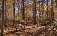
bench  at a spot where the trail turns to the right and descends
into the previously mentioned ravine.
If instead you continue north, rather than east into the ravine, you will
be hiking on the Sugarloaf Hill Trail, an unmarked but well-groomed
spur that ends 0.55 miles later at the top of Sugarloaf Hill.
The OpenStreetMap shows an
initial segment of the
trail
  ,
but incorrectly indicates that it merges into the Sugar Loop mountain
bike trail (one of the DTE Energy Foundation trails). In fact, it
crosses
  the Sugar Loop at this point and crosses it
a few more times along the way. The hilltop has a set of
stone
benches
  surrounded by a hairpin turn on the mountain bike trail,
making it a good spot for taking a break.
I've saved a freehand approximation of the
Sugarloaf Hill Trail  on MapPedometer.
There is also a map available at
trailforks.com
  .
.
Discovery Center East.
On the east side, there are three short loops (Old Field, Lowland,
and Spring Pond) and one spur (the Bog Trail). There are several ways
to link them into a single hike of 2.7 to 2.8 miles, starting either from
Marker 6  near the north parking lot, or from
Marker 1
  midway between the north and south parking lots.
In addition, the OpenStreetMap (but not the official trail map) reveals
that there are two interesting side trips to consider as a supplement
to your hike:
1. On the Spring Pond Trail, about 120 yards from its southernmost
extreme, there is a
faint
path  that leads west to an
unnamed
narrow trail
  that runs north-south. It seems likely that the path was more heavily used
in the past -- you may notice some rough cut wooden stair steps
wedged into the hillside. If you head north on the
trail you will return to the Discovery Center. The more interesting option
is to head south. For about 1/2 mile, you will climb up and down gently
rolling hills, and along a ridge with glimpses of Doyle Lake to
the west and Cedar Lake to the east. The trail ends at a gravel
road leading to a boat launch on the
south shore of
Cedar Lake
  .
This side trip will add about 1.4 miles to your hike.
Another entry point for this trail that may be easier to locate is
on the W-P Trail about 0.2 miles beyond Marker 5. When the W-P Trail
turns west and heads downhill, there will be a path on your left
leading southeast that joins the unnamed trail. This yields a
one mile route  from Marker 5 to Cedar Lake.
2. Near the end of the Bog Trail, there is a well-maintained trail
that leads east to the
Cedar Lake Outdoor Center  .
Note that this trail is not part of the Discovery Center network,
and there are
signs
  en route
indicating that access is restricted during June through September,
when the Cedar Lake Center serves as a summer youth camp.
However, it is possible to use the trail to take a short detour into the
adjacent woods without crossing into the camp, and during periods when
the camp is not in use, it is worthwhile to explore the area more
thoroughly. Highlights include a trail that passes through a beautiful
pine
grove
  -- look for the "Blue Trail" on the north side of the campground.
On the south side, there is a
gorgeous
trail
  that runs along the north shore of Cedar Lake, ending near a small
beach with a dock and an excellent
view
  of the lake. This side trip to the camp will add 1 to 1.5 miles to your hike.
I've saved a route map for a 5.35 mile hike
that includes both of these excursions on
MapPedometer  .
.
An outstanding 3 mile hike around Mill Lake can be pieced together
by combining parts of the Lakeview, Oak Woods, and W-P Trails with a
trail that passes through what was once the site of a summer youth
camp on the north shore of Mill Lake. The camp was shut down more
than 20 years ago, and hiking past the
boarded-up
cabins  has a bit of a ghost town feel to it. For more on the history of the
camp and some 2013 restoration work, see this
Ann Arbor Observer article
  .
.
Starting from
Marker 6  ,
follow the W-P Trail north for 0.3 miles to the point where it crosses
the access road for the Discovery Center. Turn left and follow the
access road southwest for about 120 yards and look for a trail on the
right shoulder that continues north. This will take you into the campground,
past a first series of cabins. After you pass the former dining hall,
look for a spur trail on your left that leads to a grassy area with some
fantastic (unobstructed!) views from the
north shore
of Mill Lake
  .
Upon resuming your loop, you will pass a second series of cabins.
Although still somewhat primitive (no running water), these cabins
have been restored and are available for campers to rent.
For the next stage of the loop, exit the campground and follow unpaved
McClure
Road  west for about 300 yards to an access road that leads south to a Mill
Lake boat launch. After taking in the
great
view
  available there, continue south to reach Marker 11 on the
Lakeview Trail. From there it should be easy to find your way back
to the Discovery Center.
I've saved a route map for a 3.2 mile version of this loop on
MapPedometer  .
Note that in addition to its suitability as a hike on its own,
the loop can easily be grafted onto a hike on the east side of the
Discovery Center, and the northern half of it can be used as an
alternate way to return from a hike on the west side.
North from the Discovery Center.
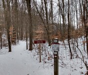
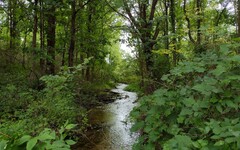


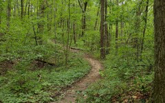
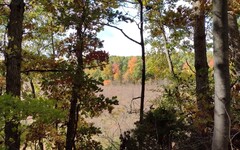
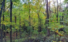
If you head north on the W-P Trail from
Marker 6  at the Discovery Center,
you will reach Bush Road (at the boundary of the no-hunting zone)
after 1 mile, Waterloo Road after 1.8 miles, Cassidy Road
after 3.1 miles, and the access road to Green Lake after 3.8 miles.
A highlight of the segment from Bush Road to Waterloo Road is a 1/2 mile
stretch along a ridge -- possibly an
esker
  -- that overlooks
forested
wetlands
  on both sides. Venturing beyond Waterloo
Road takes you through a
densely
wooded area
  and involves climbing
up and down a few steep hills. The highest point on these climbs is 120
feet above the level of the road.
After 4.2 miles, the W-P Trail reaches highway M-52 and follows a route that is new as of June 2022: it turns left (northwest) and joins the B2B Trail for the next 1/2 mile as it runs parallel to M-52 before turning east and passing through a pedestrian/bike tunnel underneath the highway. The trails diverge shortly after emerging from the tunnel -- the B2B Trail resumes its run alongside M-52 while the W-P Trail continues east and enters the Pinckney Recreation Area. You will reach the trailhead and parking area for Park Lyndon South -- the site of Hike #2 and a good place to end a point-to-point day hike -- after 6.25 miles.
I've saved a route map for this hike on
MapPedometer  .
.
Update (August 2023): At the point where you exit the B2B Trail and enter the Pinckney Recreation Area, you will surely notice evidence of the recent installation of a natural gas pipeline. [See Hike #2/pipeline.]
West from the park HQ to Baldwin Road.
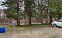
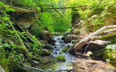
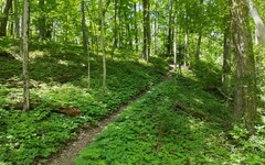

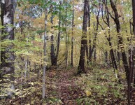
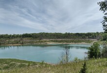
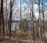
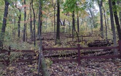
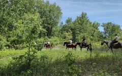
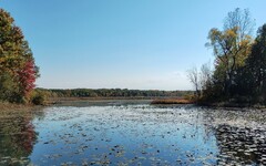
Across from the park headquarters on McClure Road (Marker 12 on the
Discovery Center trail network) is a
small
parking lot  that is a convenient starting point for hikes heading west on the W-P Trail.
After an initial segment shared with the Hickory Hills Trail
along the north shore of
Crooked
Lake
  ,
the first few miles are heavily wooded, with occasional steep hills
separating basins with ponds. On a hike there once in early spring,
the frog chorus was so loud it sounded like heavy machinery.
After 1.8 miles, you will enter a zone where the W-P Trail joins a network of equestrian trails. The first evidence of it for a westbound hiker is a fork in the trail that diverts eastbound horse riders onto a separate trail that circles back to an equestrian campground. At the 2.1 mile mark, the W-P Trail crosses Loveland Road and enters Jackson County. You will notice another fork in the trail there, for equestrians seeking a more direct route to the campground.
At the 3.0 mile mark, you will reach a junction where the W-P Trail
crosses an unnamed dirt road leading to Clear Lake.
An optional route for returning to the park HQ from there is to walk
downhill (north) on the dirt road towards the lake.
Although Clear Lake itself lies outside of the park boundary and is
surrounded by private property, after about 1/4 mile there will be
an unnamed trail on your right (northeast) heading back uphill to a
ridge offering
peeks
at the lake  .
The trail eventually returns you to the W-P Trail and a chance to
resume your journey back to HQ. A nice way to finish the last 1/2 mile
of the hike is to follow the northern half of the Hickory Hills Trail.
I've saved a route map for this 6.1 mile out-and-back hike on
MapPedometer  .
.
Some additional options for returning or continuing on your hike:
* Another return option from the junction is to
retrace your steps for 200 feet back to a
trail  that branches off to the right (eastbound) from the W-P Trail.
It runs just below the rim of a
deep
ravine
  before it reaches a second trail that heads north and
eventually rejoins the W-P Trail at Mile Marker 13. (I've saved a
map of this route
  on MapPedometer.)
The trails here are a bit rough and presumably not maintained -- you
will have to work your way over or around a few downed trees.
However, there is a reward for your troubles. If you continue east for
a short distance beyond the northbound trail, the path leads uphill
to something one rarely sees from an undeveloped hilltop in southern
Michigan: a
panoramic
view
  that isn't obscured by trees and bushes.
* If instead you continue west on the W-P Trail from the junction,
Mile Marker 12 and Hideaway Lane (mislabeled Clear Lake Road on
the OpenStreetMap) are 1/2 mile away. Along this stretch you will climb
another 60 feet in elevation to a summit and then 120 feet down along a
series of
switchbacks  .
.
If you venture beyond Clear Lake Road at the 3.9 mile mark, the trail
flattens out and the likelihood of
encountering
horses  increases. You can also expect lots of
soft sandy
soil
  (or mud, depending on the time of year).
While this may be ideal for the horses, it can be a bit
of a slog for hikers. At the 5.8 mile mark, you will reach the
Baldwin
Flooding
  -- a 63 acre wetland that serves as a popular migration stop
for waterfowl. Just beyond the marsh is a parking area off of
Baldwin Road -- an ideal location for the end of a point-to-point hike.
I've saved a route map for this 5.9 mile hike on
MapPedometer  .
.
From Mount Hope Road to Baldwin Road.
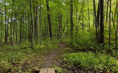
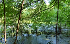
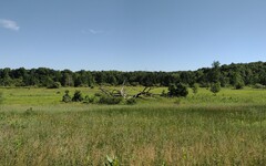

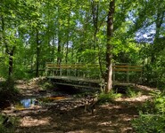

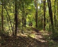
There is a
parking
area  on Mount Hope Road that can be used for staging hikes heading west
toward the W-P trailhead at Big Portage Lake (the reverse of this hike
is discussed below),
or northeast to Baldwin Road. Of course one may hike
these sections of the trail in either direction or out-and-back,
but the shorter driving time to Mount Hope gives it an advantage as
a starting point.
For a Mount Hope to Baldwin hike, the W-P Trail heads northwest from
the parking area and descends immediately through a woodsy area
before leveling out near a
small
pond  .
At the 0.6 mile mark, the trail turns eastward and crosses Mount Hope Road,
passing through a
wide
open field
  before re-entering the woods and ascending 100 feet to a road crossing
at Katz Road (mile 1.25). At this point the W-P Trail overlaps with the
equestrian
trail network
  ,
and you may find it worthwhile to incorporate some segments from this
network into your hike.
At the 1.65 mile mark, the trail follows unpaved
Glenn
Road  east for about 1/4 mile before turning north for 1.2 miles through a
wooded area. The terrain here is relatively flat and surrounded by
wetlands, so you should not be surprised to find occasional muddy
areas on the trail. There are rougher trails parallel to and east of
the W-P Trail here that you may prefer -- they generally run along higher
and drier ground.
At the 3.2 mile mark, you will arrive at a
fork
in the trail  .
Under dry or frozen conditions, you would take the left branch
for a direct route that eventually leads you across Baldwin
Road and then north to the parking area adjacent to the
Baldwin
Flooding
  .
However, you will notice that the trail
fork has signage indicating that the right branch is available as a
detour in case of seasonal flooding. Be aware that it may not be
immediately evident that the detour will be necessary, since the most
flood prone
areas
  are another 250 yards ahead. If you do make use of the detour,
you will discover that it includes a 1/4 mile walk north along the
shoulder of Baldwin Road before it rejoins the W-P Trail.
If you strictly follow the W-P Trail from Mount Hope to Baldwin Road, the distance is about 3.9 miles from parking area to parking area. A close-up view of the Baldwin Flooding will add perhaps 0.1 miles to your hike, and use of the detour will add another 0.25 miles.
I've saved a route map for an 8.9 mile round trip on
MapPedometer From the W-P trailhead at Big Portage Lake to Mount Hope Road.
Another excellent launching point for a hike is at the origin
of the W-P Trail on the western side of the park near Big Portage Lake.
(Note that the
trailhead
The trail in these initial few miles passes through a mix of
hardwood and pine forests, and the terrain is mostly gently rolling hills.
Once you cross Seymour Road, you will encounter numerous ponds and
wetland
basins Directions:
If you are headed to the Discovery Center,
take I-94 west to Pierce Road (Exit 157). Continue north on Pierce
for about 2.5 miles, where it ends at a T intersection with Bush Road.
Turn left (west) onto Bush and look for the entrance to the Discovery
Center on the left after about 3/4 of a mile. The north parking lot
is about 1/2 mile down this access road, and the south lot is about 1/4
mile farther.
If you are driving to the park headquarters,
take I-94 west to Kalmbach Road (Exit 156). Continue north on Kalmbach
for 3/4 of a mile, jog briefly to the left on Cavanaugh Lake Road, and
then right (north) onto Glazier Road. Follow Glazier until it ends
at a T intersection with Ridge Road about 1.3 miles later.
Turn right (north) onto Ridge Road, and then left (west) onto McClure Road.
Look for the parking area on your left after less than 1/4 mile.
The final 3/4 mile on Ridge and McClure Roads is unpaved.
If you are headed to the western parts of the W-P Trail,
take I-94 west to Mount Hope Road (Exit 150).
Turn right (north) onto Mount Hope and look for the parking area on
your left after 0.8 miles. Or, to reach the trailhead at Big
Portage Lake, continue north on Mount Hope for another 1.5 miles,
then left (west) on Seymour Road. Look for the entrance on your right
after about 1.75 miles and follow the signs for the trailhead and/or
the boat launch -- the two are located near each other in the
northernmost parking lot.
Driving times starting from the I-94 onramp at Jackson Road on the west
side of Ann Arbor to either the Discovery Center or the parking area on
Mount Hope Road are both about 20 minutes. The drive to park headquarters
takes a few minutes longer. It takes a little less than 30 minutes to
reach Big Portage Lake.
A Michigan
recreation passport Excerpts from the website:
[The] Waterloo Recreation Area is the largest state park in the Lower
Peninsula and is home to campgrounds, swimming beaches, trails,
the Gerald E. Eddy Discovery Center and more. It's best known for its
premiere mountain biking trails, equestrian opportunities and the
Waterloo-Pinckney Trail offering backpacking options. In addition,
there are excellent fishing, hunting and wildlife viewing opportunities.
The DTE Energy Foundation Trail is a cutting-edge, sustainable trail open
to mountain biking, trail running, hiking and cross-country skiing.
The trail parking lot will intermittently close when erosive trail
conditions exist due to wet weather. Updates will be posted on the
DTE Energy Foundation Trail Facebook page.
 . The outbound leg follows
the 3.9 mile direct route from Mount Hope to Baldwin Road, while the 5.0
mile return has several deviations, including the flooding detour
and some segments from the equestrian trail network.
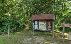

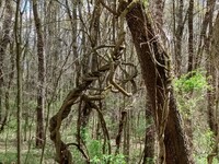
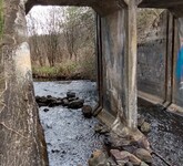

 is shown on the OpenStreetMap, but not on Google's maps.)
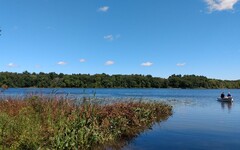
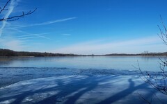
The trail takes you north and west along the shore of
Big
Portage Lake
  before curling around to the south for the next few miles,
reaching Seymour Road after 1.5 miles, List Road after 2.5 miles, and
Willis Road after 3.3 miles. If you are planning an out-and-back hike,
you may want to take note of a trail leading east at about the 0.75 mile
mark. It offers a shortcut that will shave about 1/4 mile off of your
return trip to the parking lot.
 .
Venturing further out, after crossing Glenn Road
at about the 4.1 mile mark, the
hills
  become more substantial, the highest being Sackrider Hill at an
elevation 200 feet above the level of Big Portage Lake.
Although there is a viewing platform at the top of Sackrider Hill,
the surrounding trees have grown so tall and dense that they will block
your view. (And the blockage persists even in the
wintertime
  .)
A short distance beyond this at the 5.8 mile mark is a convenient
stopping place for a point-to-point day hike -- the
parking
area
  on Mount Hope Road.
 is required for vehicle entry.