 ,
OpenStreetMap
,
Matthaei Botanical Gardens Trail
,
OpenStreetMap
,
Matthaei Botanical Gardens Trail
,
OpenStreetMap
,
Matthaei Botanical Gardens Trail
,
OpenStreetMap
,
Matthaei Botanical Gardens Trail
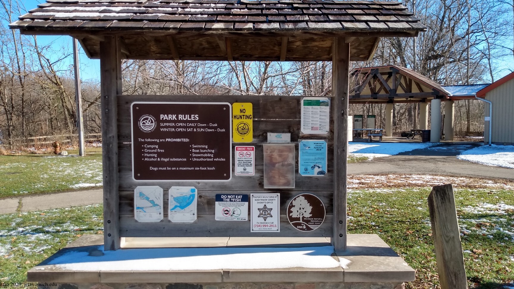
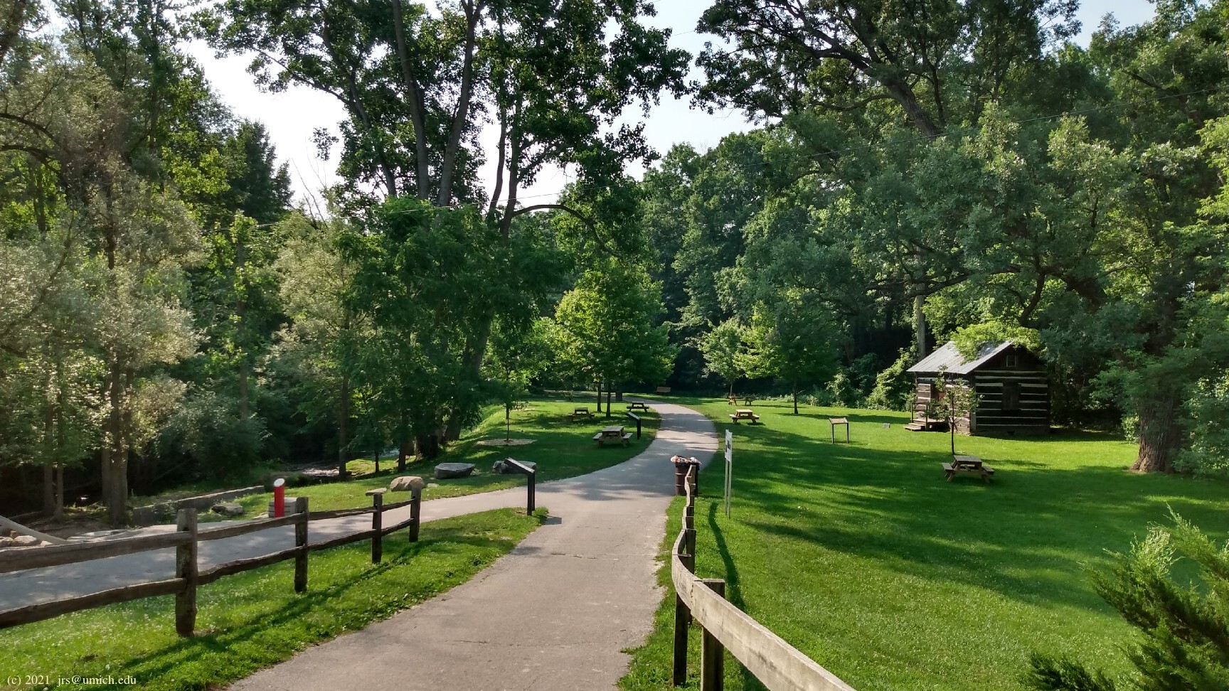
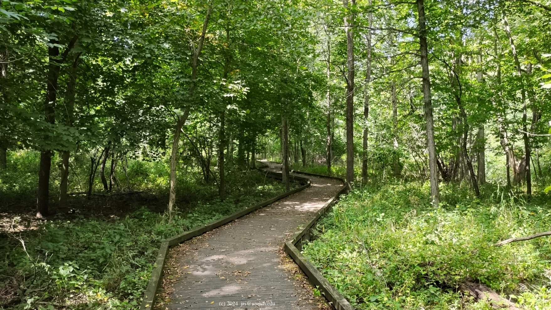
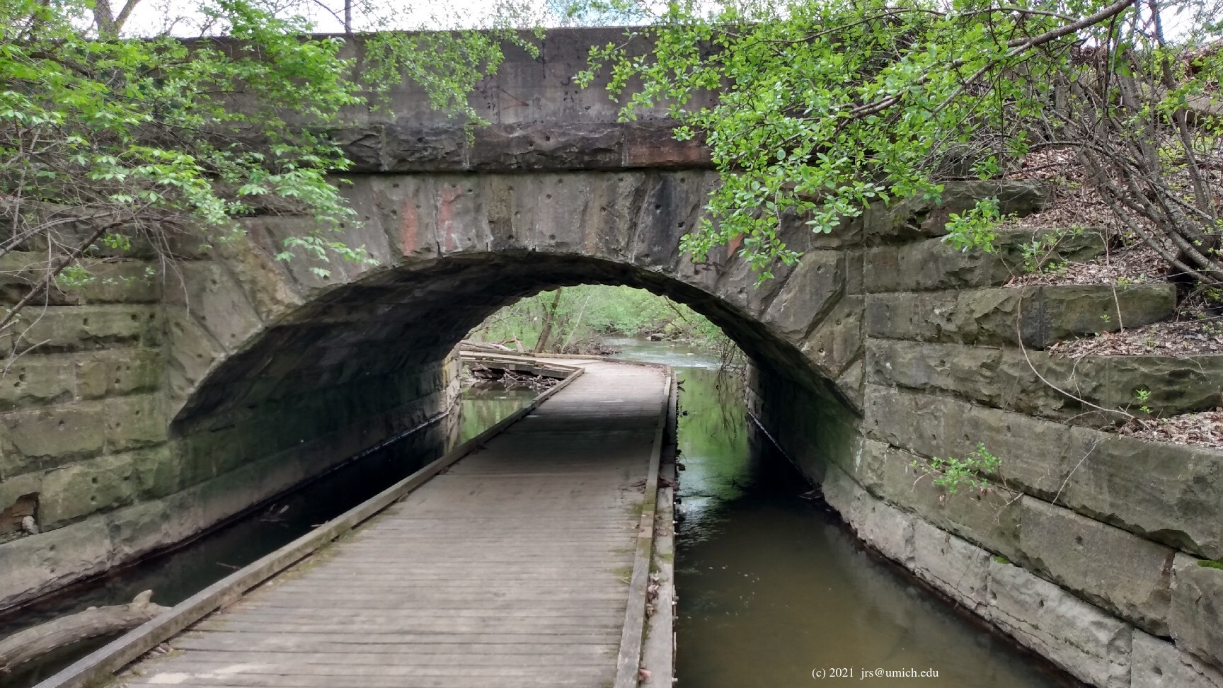
Photos from Parker Mill:
Overview:
The Matthaei Botanical Gardens Trail (not to be confused with the
trail network within the Botanical Gardens) is a 2 mile paved
bike/pedestrian
pathway  that connects the MBG and the B2B Trail.
Although a 4 mile out-and-back side trip on asphalt is substantially
inconsistent with my guidelines for inclusion on The List, there are
some compensating features that make this worthy of consideration
as a supplement to Hike #18.
that connects the MBG and the B2B Trail.
Although a 4 mile out-and-back side trip on asphalt is substantially
inconsistent with my guidelines for inclusion on The List, there are
some compensating features that make this worthy of consideration
as a supplement to Hike #18.
Planning your route:
The Gallup Park Pathway (a sidetrack of the B2B Trail) serves as the
backbone of the trail network at Parker Mill. If you head south on this
pathway from the mill, you will gain access to the
Sugarbush
Trail
(an unpaved 0.2 mile loop) and the 1.2 mile Hoyt G. Post Trail.
Continuing farther south, the pathway eventually turns west, crosses
the Huron River, and joins up with the B2B Trail at the eastern edge
of Gallup Park [part of Hike #13].
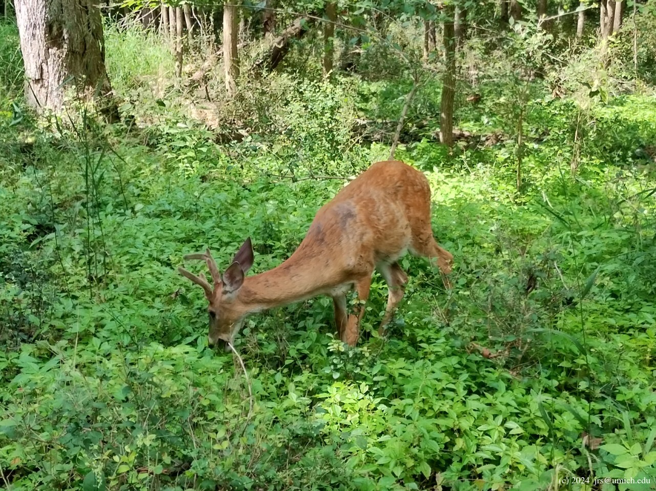
The Hoyt G. Post Trail is particularly interesting. It consists entirely of
elevated boardwalks
and viewing platforms with interpretive signs to guide you through a
floodplain forest adjacent to Fleming Creek.
I have frequently encountered
deer
here that are nearly tame --
perhaps some local residents are feeding them.
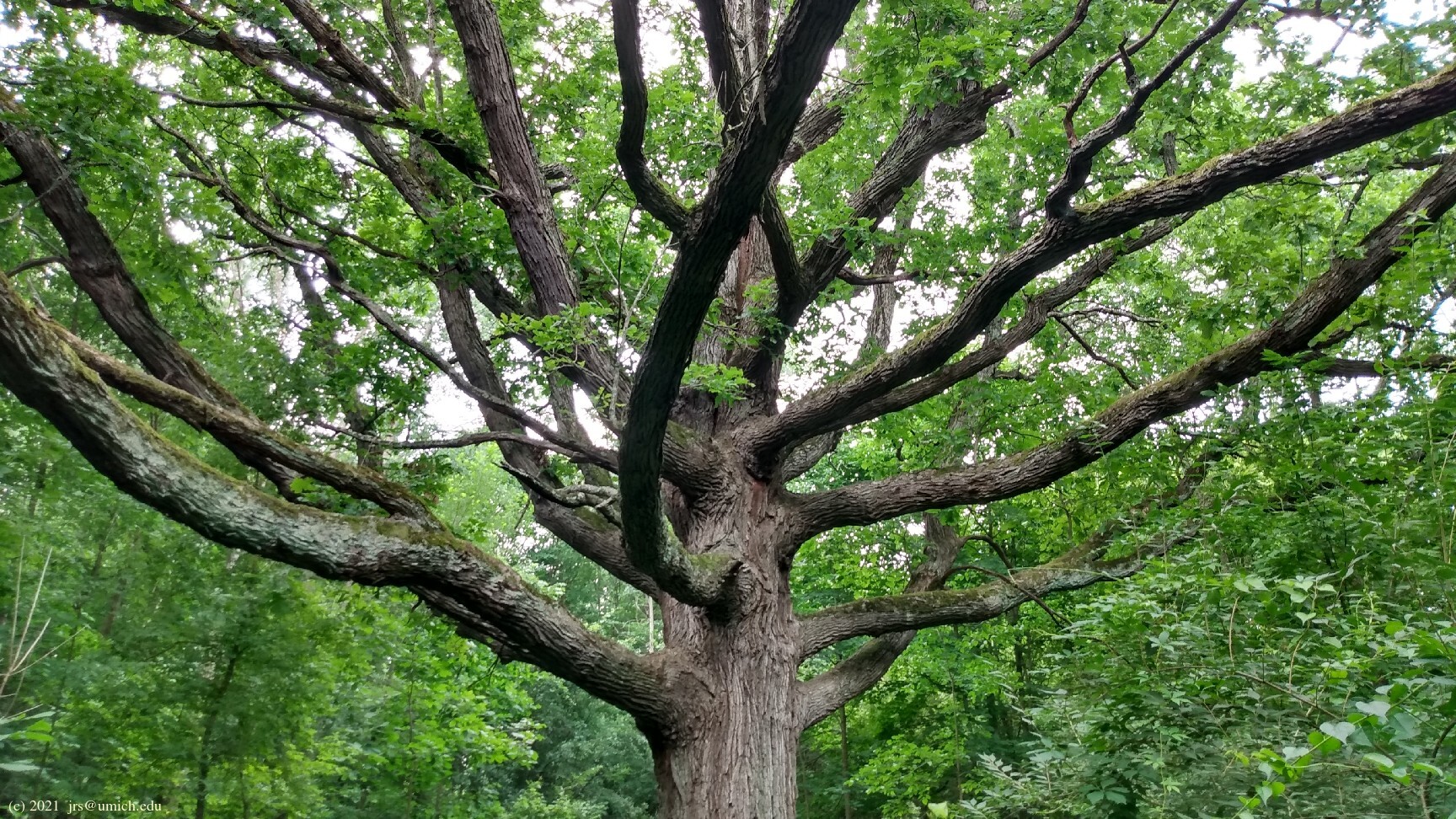
The southernmost part of the trail (south of the railroad tracks)
ventures into the 17 acre
Forest Nature Area
and takes you all the way to
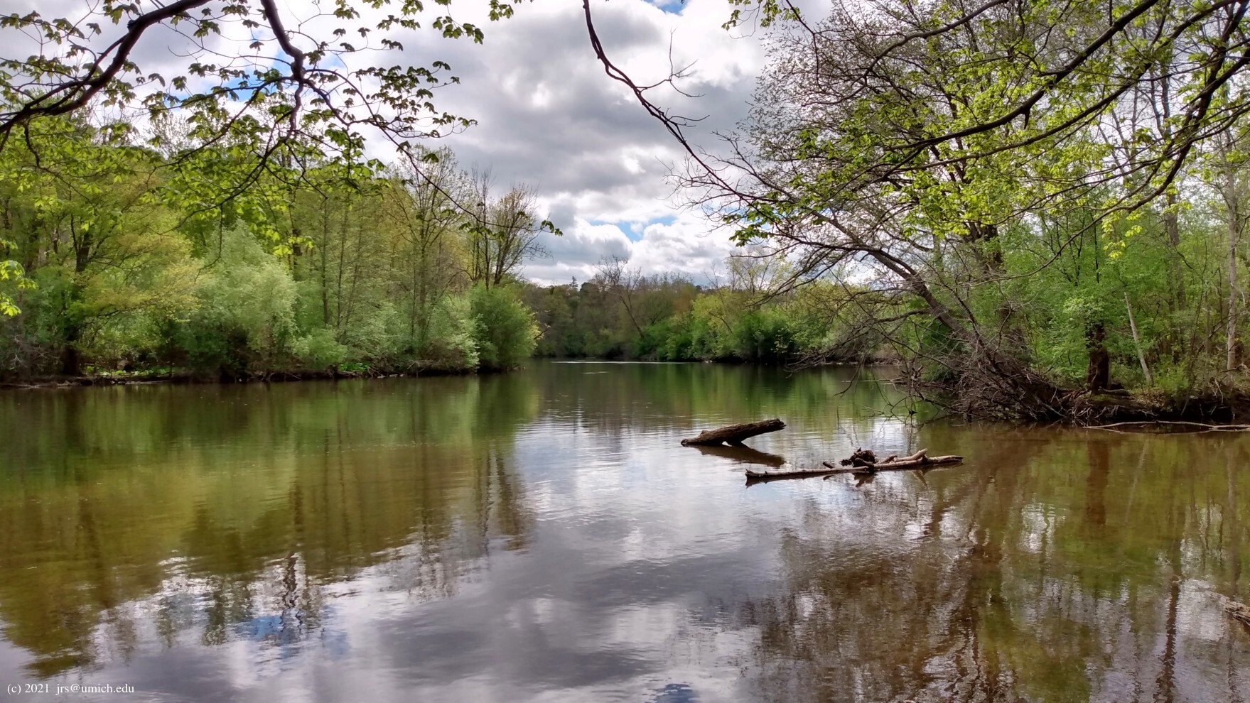
the spot where Fleming
Creek feeds into the Huron River .
Keep in mind that if there happens to be a breeze from the west while
you are exploring these southernmost parts, your nose will confirm that
Ann Arbor's wastewater treatment plant is nearby.
Heading north on the Gallup Park Pathway from the mill, you will
pass under Geddes Road and turn west towards Dixboro Road.
Along here you will find the entrance to the Post Legacy Trail,
a 0.25 mile unpaved loop featuring a
pavilion with a roof
made from vegetation .
Continuing west on the pathway takes you to the start of the MBG Trail,
at the northeast corner of Dixboro and Geddes Roads.
In addition, a mere 120 feet west of the entrance to the Post Legacy Trail
there is an
inconspicuous footpath
(clearly shown on the
OpenStreetMap )
leading downhill into the underbrush on the west side of Fleming Creek.
[Update: It is even easier to spot this footpath now that the
township has planted a
tree
that marks the exact spot.]
After a short distance down this path you will arrive at a chain link fence
marking the boundary of Radrick Farms, a large University of Michigan
property that includes a golf course and an "Adventure Education Center".
You will also notice that the fence has been cut vertically and rolled up, leaving a 6 foot wide opening for the path to continue. However, there is also a "No Trespassing" sign here, so no one who respects property rights actually goes beyond this point. As a result, what I am describing here is totally hypothetical, being about what would happen to a scofflaw who continued on this path.
What the scofflaw would find, hypothetically, is a narrow, rough-hewn trail
that heads north along the west side of Fleming Creek. It might be muddy in
places, with a few tricky stream crossings along the way. Eventually it
joins the MBG Trail a short distance south of mile marker 0.75.
If you are headed south on the MBG Trail, you can spot this path at
the end of a
wooden guardrail
where the MBG Trail takes a sharp turn.
There is a second opportunity farther north to go off-road, with no
hypothetical trespassing involved. After you pass mile marker 1.5,
look for a spot where the pathway emerges from a wooded area, with a
footpath running north
(on your right) between a line of trees and farmland (part of the UM
Campus Farm). This path will take you directly to the parking lot of
the Campus Farm and from there into the Botanical Gardens, avoiding the
last leg of the MBG Trail that runs alongside Dixboro Road.
To illustrate a (purely hypothetical) round trip
heading north to the Botanical Gardens using the rustic options and
returning conventionally via the MBG Trail, I've saved a route map on
MapPedometer .
Of course bikes and leashed dogs are allowed on the MBG Trail and Gallup Park Pathway, but neither are allowed on the Hoyt G. Post Trail or the Post Legacy Trail.
Directions: From central Ann Arbor, head east on Fuller Road for about 3.5 miles. Along the way, Fuller becomes Geddes Road. After passing through three roundabouts and crossing Dixboro Road in quick succession, look for the parking lot for Parker Mill on the right (south) side of Geddes.
Excerpt from the websites: Parker Mill County Park, together with the City of Ann Arbor's Forest Park, is a 45-acre tract of mostly wooded land that encompasses the tail end of Fleming Creek, including its mouth, where it joins the Huron River. The historic operating grist mill is one of the highlights of the park.
The [Hoyt G. Post Trail] leads the hiker through an excellent example of a wet forest including black maple, hackberry and rock elm and has interpretative signs throughout.